Category for Mobility

Category_Dashed: 
mobility-and-access
Case Studies
Troutdale

Multnomah, Oregon

categories
benefits
beautify streetscape, 
build community, 
improve environment, 
slow traffic, 

Background

The Historic Columbia River Highway runs through downtown Troutdale in Oregon. It is an approximately 0.3 mile long and 50-foot wide boulevard, which consists of a 12-foot wide travel lane, an on-street parking lane, and a striped bike lane in each direction. The sidewalk on the north side is 8 feet to 9 feet wide while the one on the south side is approximately 4 feet at the narrow points. Crosswalks are in place at most intersections along this section.

Columbia River Highway in Troutdale (photo credit: Google Earth 2011).

It is a very popular route for weekend cyclists heading to the Columbia River Scenic Gorge. Traffic volumes are not excessive outside of peak hours. The street cross section with parking, wide sidewalks and zero setback storefront affords an improved retail draw for the area (Valencia 2011).

Troutdale's historic, five-block main street was in serious decline by the late 1980s. But a series of changes reversed the trend in the 1990s. The City attracted the Columbia Gorge Factory Stores, immediately adjacent to the downtown area along Interstate-84. The mall brings thousands of shoppers to this eastern gateway to the Portland region, setting up a larger market for the main street.

Troutdale gateway (photo credit: Jim Clark).

The creation of the Columbia River Gorge National Scenic Area established Troutdale as the de-facto gateway to the Gorge from the Portland metropolitan area since the city abuts the scenic area’s western edge. The Oregon Department of Transportation (ODOT) bolstered the new scenic area designation with a major restoration of the Columbia River Highway to its former glory, attracting more visitors through downtown Troutdale en route to destinations in the Gorge like Crown Point and Multnomah Falls.

Downtown Troutdale (photo credit: McD22 via Flickr).

The project initially focused on the north side of the Columbia River Highway, a move that might have seemed ill-advised since most of the original storefronts were on the south side of the street. Yet, this strategy resulted in a ‘complete” main street, and is making the vacant parcels on the south frontage much more attractive as development continues.

Columbia River Highway (photo credit: Nubby Twighlet).

A number of the new structures also include mini-plaza areas in their entry designs that expand the pedestrian area where it is needed most. The project also retains the historic street lamps that have decorated this section of the Columbia River Highway since it was constructed in the early 1900s. On-street parking was preserved on both sides of the street - a significant accomplishment in a state DOT-owned facility. The project also includes Mayor's Park, with a small plaza, seating and drinking fountains. Though modest, it serves as an important public gathering space in Troutdale.

Another piece to the puzzle was the acquisition of a former county poor farm, located just west of the downtown, by an eccentric brewpub chain operated by Mike and John McMenamin. Together the brothers converted the farm into McMenamin's Edgefield Estate, a sprawling campus with hotel, brewpub and winery that is now listed in the National Historic Register.

Downtown shops (photo credit: City of Troutdale).

The City of Troutdale partnered with private developers to aggressively rebuild the missing half of storefronts along the north side of Columbia River Highway. In a unique public-private partnership, a row of nearly two dozen new storefronts has been constructed since 1995 on land originally owned by Union Pacific Railroad.

Adopted from: Green Streets

In 2010, the 68-foot steel Centennial Arch was built as a welcoming gate to the downtown area. It is designed to withstand winds up to 110 mph and 3 inches of ice. Built-in lighting illuminates the two metal support sculptures at night. While the project cost approximately $363,000, the city and community expect this inviting arch will bring more tourists and economic boom to the community (Wells 2010).

Lessons Learned
Potential Benefits:

  • Preserves neighborhood identity.
  • Provides cycle lanes and access.
  • Increases green space by providing mini-plazas and parks.
  • Provides access to Interstate 84 and Columbia River Gorge.
  • Creates an interesting small downtown area with some unique shops.

Potential Issues:

  • Narrow sidewalk: The new striped bikeways on both sides of the street came at the price of relatively narrow sidewalks. The innovative mini-plaza design on several newer buildings increases pedestrian space. However, the sidewalk still feels cramped.
  • Lack of adequate pedestrian crossings: Markings at all intersections and curb extensions at some intersections would be major improvements, as well as a controlled intersection at Buxton Avenue, where vehicles routinely fail to yield to pedestrians when making turning movements.
  • Wind issues: Cold wind blasts out of Columbia River Gorge most of the year.
  • Visual access: Most people miss the downtown shops due to the huge Factory Outlet complex by Interstate 84.

Sources

Wells, Shannon, March 16, 2010. “Arch rises above downtown Troutdale” Portland Tribune (http://www.portlandtribune.com/news/print_story.php?story_id=126878903191947000)

Glabah “Oregon Gateway to Gorge and Local Shopping“ (http://members.virtualtourist.com/m/5f9c8/d0600/)

Green Streets (http://www.greatstreets.org/MainStreets/MainStTroutdale.html)

Interview with Joanna Valencia, Transportation Planner, Multnomah County Department of Community Services, Land Use & Transportation Program on July 1, 2011

Photo Sources

MIG, Inc.

Case Studies
Cheong Gye Cheon Stream Restoration
Seoul, South Korea
categories
benefits
beautify streetscape, 
build community, 
improve environment, 
reduce health disparities, 
reuse underutilized land, 

Background

Cheong Gye Cheon corridor. Source: Google Earth 2012

Cheong Gye Cheon is a dramatic transformation of a site with more than a 5 mile long concrete roadway with an elevated highway into a vibrant public recreation open space running that serves the old central business district area of Seoul. More than a century ago, the Cheong Gye Cheon (CGC) was called Gaecheon or "open stream" and served as a major water resource for its neighborhoods. During the 1950s and 60s, the urbanization of the city and increasing industrial development polluted the stream and it was covered with concrete roads. Soon, an elevated highway was built to meet the increasing high transportation demand for the heavily industrialized city center. In the 1980s, the impacts of the highway and effect to the economic decline of the central areas became clearly recognized. People began to be concerned about air pollution from the highway, health risks from unsanitary conditions and a decreasing stability of the aging infrastructure. A group of academics and environmentalists developed a community-based master plan for demolishing the 10-lane highway and restoring the stream. In 2002, Seoul Metropolitan Government established an organization to move the project forward.

The green corridor in central Seoul. Source: MIG

By 2003, the freeway had been completely disassembled. The restored CGC stream and the linear park were opened to the public in October 2005. The greening of central Seoul created a great amount of public amenities, but this resulted in a significant loss in road capacity. To relieve possible traffic congestion impacts, the Seoul Metropolitan Government improved the public transit system. The city opened 40 miles of dedicated rapid-bus lanes along major arterials. In 2004, the city reconfigured bus routes to feed more effectively into the city’s subway system (Kang and Cervero 2009). As a result, the daily traffic volume of the CGC area, which was about 168,556 in 2001, had decreased. In 2006, the bus and subway ridership of the inner city had increased by 11% and 13.7% respectively (Park 2007).

Project Description

The redesign of the corridor provides an opportunity to celebrate history and tradition with the ceramic tile wall  commemorating a key historic event in the Chosun Dynasty. Source: MIG

  • The project took about 27 months to construct and cost about $346 million. It involved the demolition of 3.4 miles of elevated structures which helped in the formation of a new 3.5 mile long watercourse and river bed. The construction of 22 new bridges dramatically improved the overall multi-modal mobility across the corridor. Overall, over 3.6 miles of the corridor has been landscaped. The landscape design concept took into account the creation of three different sectors, each with its own cultural theme: The upstream section represented history and tradition, the midstream represented culture and modernity and the downstream section represented nature and future. The average project cost per sector was estimated to be about £60 million. Landscaping focused on providing a balance between improving urban ecology and public access. The northern side of the river provides seating and strolling areas for people, while the southern side is designed for plants and wildlife. Small squares, public art works and waterfront decks are located at regular intervals along the river.
  • Adopted from: Shin and Lee 2006

    The redesign greatly improves the amount of landscape open space in Seoul. Source: MIG

    While the restoration of CGC increased the amount of green space and provided east-west walk paths in the central city, the reduction of the road width and the elimination of the highway greatly improved north-south connections for pedestrians. Moreover the improved public transit systems made trips to central business district destinations easier and faster. A total of 22 vehicle and pedestrian bridges were built across the restored river at the locations of all existing intersections and crossings. This included the restoration of the old Gwang-Tong bridge that had been buried under the highway structure for four decades. The dimensions of bridges vary from 65 feet to 380 feet long and from 85 feet to 193.5 feet wide.

    Prior to the highway demolition, many small shopkeepers and merchants who had stores alongside the highway opposed the project out of fear of losing business. Through a intensive negotiation process, the Seoul Metropolitan Government was able to proceed with the plan by financially compensating merchants and relocating a number of shops to a newly constructed market center. As demolition was carried out in a densely populated and trafficked area, it was vital to keep dust and noise to a minimum as well as minimize disruption to traffic. Structures were cut to maximum sizes to reduce the number of transport movements, and they traveled mostly at night. After opening the park, to encourage community participation, a wall of hope program was developed. The participants wrote their wishes on a 100 mm by 100 mm ceramic tile, which was then permanently bonded to one of the embankment walls. More than 20,000 people took part.

    The outer section of the previous road deck is maintained and redesigned as a new two lane road. Source: MIG

    The original width of the stream was kept and the bed was lowered to prepare for potential floods. The outer parts of the previous road deck were also retained to carry a new two-lane side road and to allow space for flood flows underneath. A new sloping embankment wall was then built alongside. The final river cross-section varies from 65 feet wide upstream to 380 feet downstream. Low-level terraces have been built along both sides of the river to provide people and wildlife easy access to the water.

    One of the most controversial issues was supplying a sufficient amount of water to the restored CGC. It was finally decided to provide a daily supply of 1,006,370 bbl, which would maintain an average depth of 1.3 feet and average current velocity of 0.25 m/s. The water supply consists of 838,640 bbl from the Han River and 167,730 bbl of groundwater infiltration. In addition, the design had to take into account the risk of wastewater and polluted rainwater runoff overflowing into the river during storms because the Cheong Gye Cheon area has a combined sewage system. Large sewers have thus been built alongside the river to provide additional retention for stormwater and to protect its newly established ecological system.

    Lessons Learned
    Potential Benefits:

    The outer section of the previous road deck is maintained and redesigned as a new two lane road. Source: MIG

    • Reduces urban heat island effect (Noh 2006).
    • Increases open space and recreational opportunities in the civic center area.
    • Enhances tourism in the central business district. In the first three months following its restoration, a quarter of all Koreans—about 10 million people—visited the river.
    • Enhances the pedestrian experience: While the design created a wide variety of pedestrian amenities including sidewalks and nighttime lighting, the edges of the revitalized green corridor has attracted new pedestrian friendly uses, especially in buildings adjacent to the river which have become restaurants and cafés, providing food and seating for pedestrians.
    • Increases wildlife habitat in the urban area.The number and range of birds, insects and fish now living in and around the river are on the rise.
    • Enhances economic vitality.The land values around the green space have increased, and large-scale reconstruction and redevelopment projects are now being undertaken along the whole corridor.
    • Recycles the demolished structures. The total weight of the demolished structures was 907,000 tons, including 79,000 tons of concrete, 82,000 tons of asphalt concrete and 35,000 tons of steel. Around 96% (839,000 tons) of concrete and asphalt concrete was recycled, mostly as sub-base material for road construction. All reinforcing steel was sent to mills for recycling (Shin and Lee 2006).

    Potential Issues:

    • Traffic congestion concerns: There were strong community concerns about traffic congestion caused by reduction in highway capacity. The traffic congestion issue was dealt with by introducing a new multi-modal transportation policy and with a strong focus on public transport.
    • Construction delay: During the rainy season, the river flooded within 30 minutes. This caused many constraints to riverbed work and led to construction delay.
    • Economic loss to businesses during construction work: Due to the extent and length of construction time, there was some economic loss to existing businesses during construction. To minimize the construction impacts, the City provided a stability fund to facilitate relocation. To enable this, the project team held around 4,000 meetings with residents, either individually or in groups.

    Sources

    Kang, C. and Cervero, R, 2009. “From Elevated Freeway to Urban Greenway: Land Value Impacts of the CGC Project in Seoul, Korea.” Urban Studies 46(13) 2771-1794

    Noh, S., 2006. “Cheonggyecheon Restoration In Seoul” Presentation at Minato Water Meeting, Tokyo, Japan

    Park, K., 2007. National Archives & Records Services (http://contents.archives.go.kr/next/content/listSubjectDescription.do?id=006448&pageFlag=A)

    Shin, J. and Lee, I., November 2006. “Cheong Gye Cheon restoration in Seoul, Korea,” Civil Engineering 159 Pages 162–170 Paper 14775

    Photo Sources

    MIG, Inc.

Case Studies
Octavia Boulevard
San Francisco, CA
categories
benefits
beautify streetscape, 
build community, 
improve environment, 
reduce health disparities, 
reuse underutilized land, 

Background

Octavia Boulevard Source: Google Earth 2012

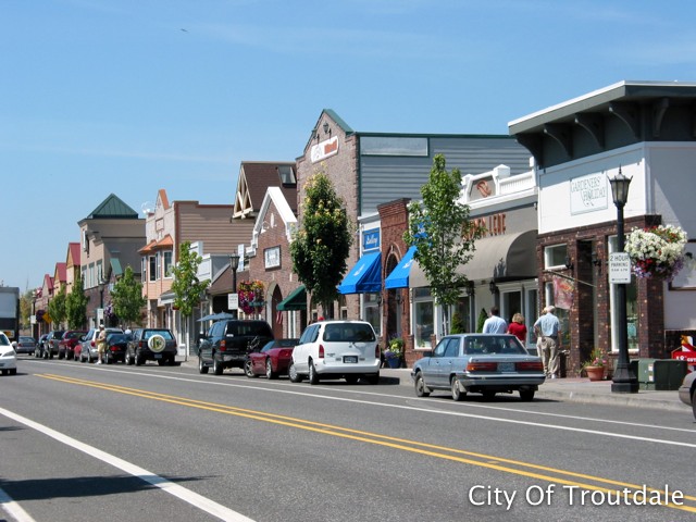
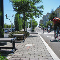
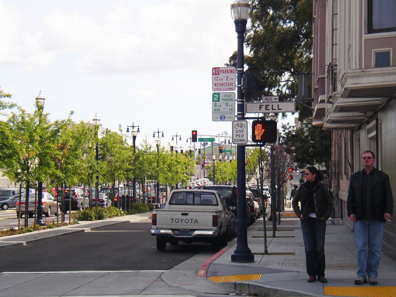
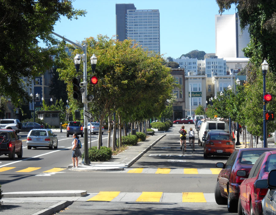
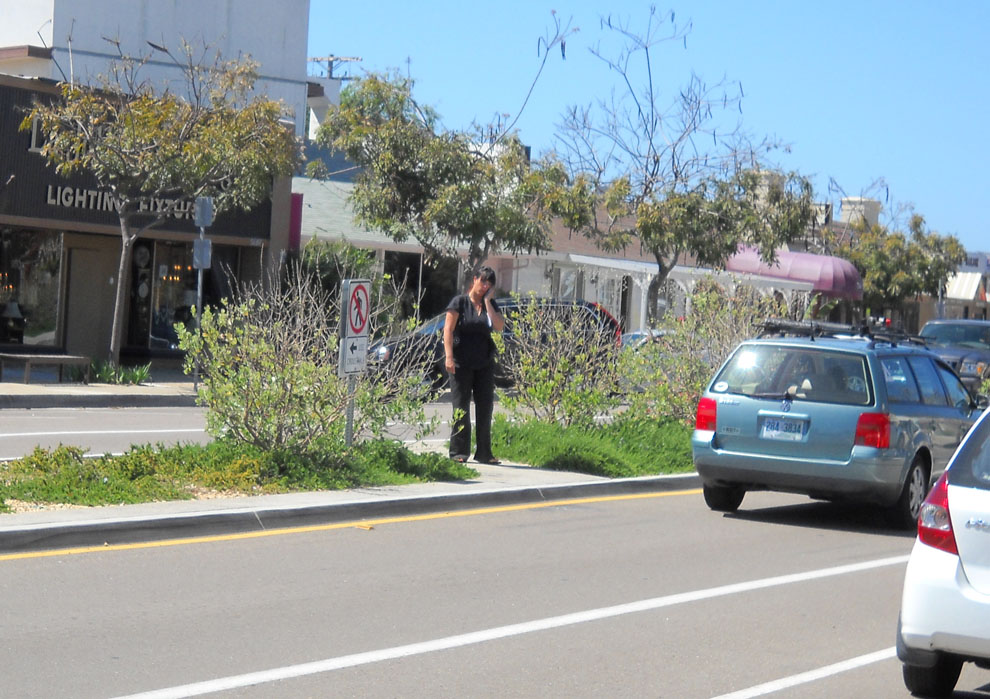
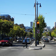
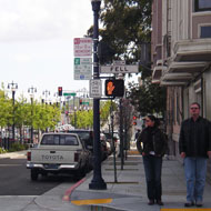
Octavia Boulevard lies on Octavia Street between Fell and Market Streets in San Francisco, where the touchdown ramp of the elevated Central Freeway starts. The four blocks of Octavia Street became a boulevard in 2005, and include four central lanes of one-way, high-speed traffic. Local access side lanes are separated from through traffic by landscaped medians that buffer cyclists, pedestrians and residents from traffic. The surrounding neighborhood of Hayes Valley, blighted by the freeway since the 1950s, has been revitalized and has become livelier as housing fills in a strip along the boulevard's east side left vacant by the freeway's demolition.

Octavia Boulevard. Source: MIG

The freeway removal had long been discussed, but it was spurred by the irreparable damage of portions during the Loma Prieta earthquake of 1989. In November 1998, San Francisco voters approved Proposition B, a measure that authorized Caltrans to replace the Central Freeway with an elevated structure to Market Street and a ground-level boulevard from Market along Octavia Street to Fell Street. The Central Freeway Replacement Project, a joint project between the City, Caltrans and the San Francisco County Transportation Authority, began in March 2003 with the demolition of the existing Central Freeway structure.

Well-landscaped medians separate through travel lanes and local access lanes. Source: MIG

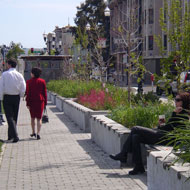
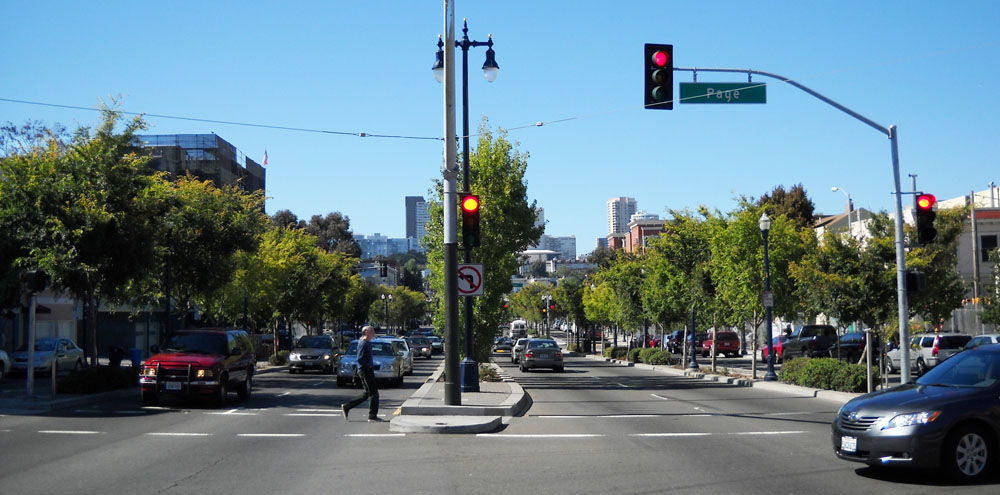
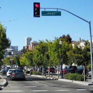
Despite the concerns about traffic congestion with the freeway removal, the boulevard distributes traffic smoothly and evenly throughout the immediate neighborhood while maintaining links to the major San Francisco traffic arterials served by the old elevated freeway, including Fell and Oak Streets, serving the city's western neighborhoods,and Franklin and Gough Streets, serving northern neighborhoods and the Golden Gate Bridge. The demolition of the existing freeway structure and the construction of its replacement touchdown ramp were undertaken by Caltrans at a cost of $26 million. At the boulevard’s northern end where it meets the retail strip of Hayes Street, a new 16,500 square foot park, Patricia’s Green, was built as part of the project. Parcels freed up by the freeway demolition are being redeveloped into nearly 1,000 units of housing. The corridor, which used to carry 93,000 vehicles per day before elimination of the eastbound lanes, now serves 45,000 vehicles per day with some of the remaining traffic displaced onto alternate routes.

Adopted from: Seattle Department of Transportation 2008

Two urban planners—Allan Jacobs and Elizabeth Macdonald—initiated the idea of a livable boulevard in American cities. The “Great Street” book, a culmination of their study, concludes that boulevards can be pleasant, functional and, contrary to their reputation in America, not dangerous at all (Ward, 2005).

Pedestrian friendly sidewalks along local access lanes. Source: MIG Source: MIG

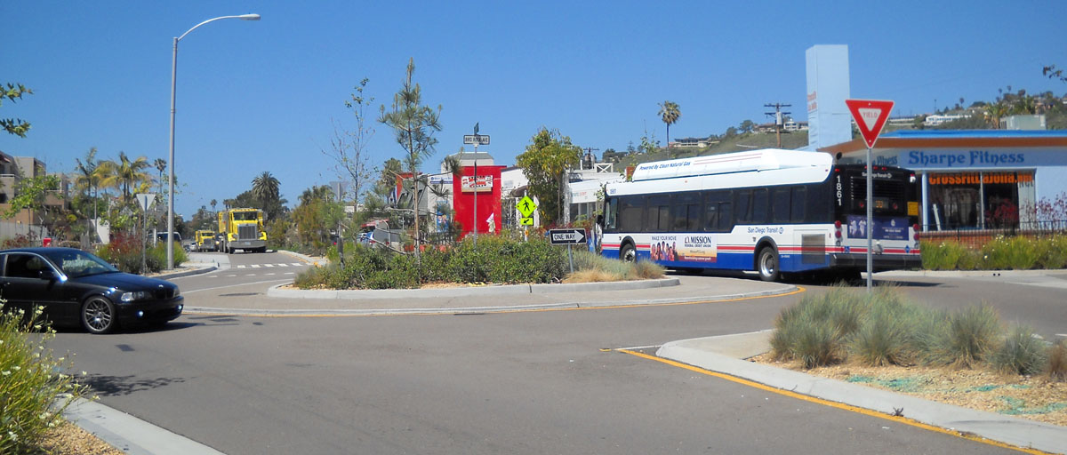
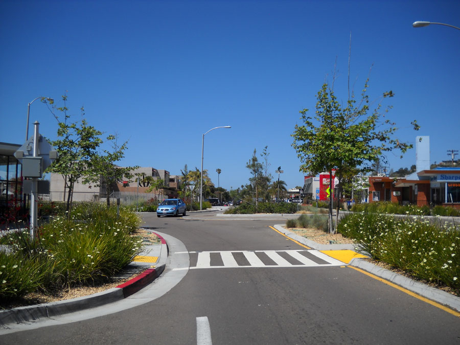
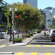
The new Octavia Boulevard is visually appealing and pedestrian-friendly, thanks to generous landscaping, side lanes for local traffic and parking, special considerations for details like views from side streets, and pedestrian amenities, such as special light fixtures, paving pattern and art. The new park, Patricia’s Green and tree-lined pedestrian walkways add more green space, functioning as a linear park in the neighborhood.

The streetscape improvements has catalyzed new private mixed use development.  Source: MIG Source: MIG

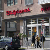
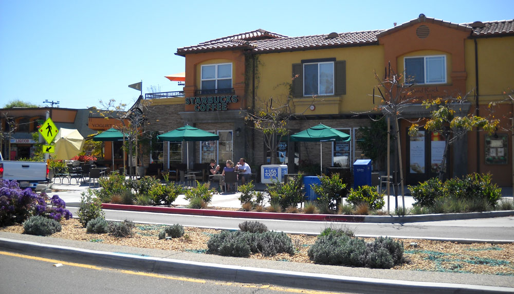
Before the destruction of the Central Freeway, condominium prices in the Hayes Valley neighborhood were 66% of San Francisco average prices. However, after the demolition and subsequent replacement with the new Octavia Boulevard, prices grew to 91% of city average. Beyond this, the most dramatic increases were seen in the areas nearest to the new boulevard. Furthermore, residents noted a significant change in the nature of the commercial establishments in the area. Where it had been previously populated by liquor stores and mechanic shops, soon the area was teeming with trendy restaurants and high-end boutiques.

Adopted from: Congress for the New Urbanism

Well designed pedestrian and bicycle facilities.   Source: MIG Source: MIG

The streetscape design has created new pedestrian and bicycle facilities without dramatically impacting automobile traffic. In February 2007, the San Francisco Department of Parking and Traffic published an evaluation of boulevard operations and its impacts on the surrounding area. Despite the reduced capacity of Octavia Boulevard, traffic along detour routes in the adjacent South of Market district returned in the months after its opening to pre-freeway closure levels. Of the half-dozen points observed, three experienced decreases in traffic, while none experienced increases greater than 10%. This, along with the reduction in traffic on Fell and Oak streets, would seem to indicate a significant reduction in discretionary trips and overall traffic in the corridor. A 1996 survey conducted six weeks after closure of the freeway’s eastbound lanes found that just 2.8% of former freeway drivers no longer made their trips and just 2.2% of trips had been shifted to transit. However, nearly 20% of respondents said that they had made fewer trips since the freeway’s closure.

Because the new boulevard did not open for several years after the freeway closure, it was initially perceived as a significant addition of capacity for drivers. During the initial weeks after the boulevard opened, the city increased the number of traffic control officers in the area, and it made a number of adjustments to signal timings until the new system reached equilibrium.

Adopted from: Seattle Department of Transportation 2008

Lessons Learned
Potential Benefits:

  • Improves safety: Provides a safer environment for pedestrians with more sidewalks and medians, residential access lanes, and less crime. The at grade street design also helps create more eyes on the street and improves the overall sense of safety.
  • Increases real estate value and spurs residential and commercial development.
  • Increases pedestrian amenities, such as parks, green space and street furniture.
  • Decreases traffic volume and, thus, air pollution and noise in the neighborhood.
  • Generates revenue from sales of excess freeway right-of-way space to fund construction of public amenities such as Hayes Green.

Potential Issues:

Despite the new at grade pedestrian facilities, the crosswalk is very long. Source: MIG Source: MIG

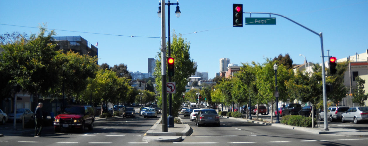
  • Some backups and spillover: Peak-hour congestion on Octavia Boulevard has sometimes resulted both in backups on Oak Street and spillover onto the parallel neighborhood streets—Page Street and Haight Street.
  • Transit delay: Buses on Page Street, which cross the boulevard, can be delayed during the morning peak.
  • Safety issues: Injury accidents have increased at a rate consistent with increases in traffic--the approximate reported collision rate of the intersection (average daily traffic of 45,000 on Octavia Boulevard and 5,500 on Page Street) is 0.06 collisions per million vehicles entering the intersection (Olea 2007).
  • Illegal right turns: Where Market Street meets the boulevard and Central Freeway, motorists regularly make illegal right turns onto the freeway and sometimes collide with bicyclists—colored pavement in the bicycle lane is under consideration.
  • Long crosswalks: Pedestrians found that the crossing signal time is too short to get across the wide street right-of-way (approximately 109 feet) (SFCTA).
  • Implementing initial design concept: Several original design features were not incorporated in the final configuration.
    • At 18’-6” the side lanes are wider than was intended, and their asphalt pavement is not the textured, traffic calming surface that was recommended.
    • Side lanes are controlled not just by stop signs, but also by flashing red lights; yet the 2007 evaluation found a fair amount of noncompliance, confusion and risk among drivers.
  • More traffic calming features:
    • Traffic volume in the side lanes: While the side lanes were designed to serve as access routes for local residents and businesses, traffic queued along the southbound side lane at the boulevard’s northern end, resulting in a requirement that drivers turn right.
    • Traffic speed: The side roads are signed for a speed limit of 15 MPH, but according to a one-day speed survey taken in 2006, 85 percent of motorists traveled at speeds of 27 MPH or lower on the northbound side roads.
    • Speed humps: In 2009, speed humps were added to the northbound side road segments, resulting in 85% of traffic speeds dropping to 22 MPH and traffic volumes dropping by almost half (Olea 2007).

Adopted from: Seattle Department of Transportation 2008

Sources

Congress for the New Urbanism. “San Francisco's Octavia” (http://www.cnu.org/highways/sfoctavia)

San Francisco County Transportation Authority (SFCTA). “Central Freeway and Octavia Boulevard Circulation Study” (http://www.sfcta.org/octaviacirculation)

Seattle Department of Transportation, January 2008. “Seattle Urban Mobility Plan Briefing Book-Chapter 6. Case Studies in Urban Freeway Removal” (http://www.seattle.gov/transportation/briefingbook.htm)

Olea, R, 2007. “San Francisco’s Octavia Boulevard” (http://www.westernite.org/annualmeetings/sanfran10/Papers/Session%202_Papers/ITE%20Paper_2B-Olea.pdf)

Ward, J, June 13, 2005. ”Where the highway ends” Metropolismag. (http://www.metropolismag.com/story/20050613/where-the-highway-ends)

Photo Sources

MIG, Inc.

Case Studies
La Jolla Boulevard

San Diego, CA

categories
benefits
beautify streetscape, 
build community, 
improve environment, 
reuse underutilized land, 
slow traffic, 

Background

La Jolla Blvd corridor. Source: Google Earth 2012

The Bird Rock neighborhood is located south of La Jolla in the city of San Diego. It is a coastal community with a population of about 16,000. La Jolla Boulevard is the primary vehicle route to La Jolla from the south, connecting to a network of residential and collector streets in the Bird Rock area. There had been safety and air pollution problems because of cut-through traffic on the wide corridor. The residents are concerned about the high rates of speed (38-42 mph), difficulty of crossing La Jolla Boulevard and peak hour congestion at a local school. In addition, a shortage of parking in the area, lack of comfortable public space, aesthetic condition and financial stagnation of area businesses were additional issues that needed to be addressed. The wide, heavily trafficked road functioned as a barrier that divided the neighborhood physically and psychologically.

A comprehensive traffic management plan was developed, addressing residents’ concerns about potential congestion and spillovers due to reduced road capacity. Through a multitude of community meetings and charrettes, the Traffic Plan was developed and approved by the community in 2003. The City Council approved the plan the following year. After three years of design process, the first phase of construction began in 2007.

Roundabouts and medians help create pedestrian friendly short sidewalks. Source: MIG

The plan includes a series of roundabouts, medians, diagonal parking on the west side and parallel parking on the east side. On La Jolla Boulevard, pedestrians once had 68 feet of pavement to cross when crossing the street. With implementation of roundabouts and medians, pedestrians would cross only one traffic lane or 14 feet of pavement at a time. The street was redesigned as one lane in each direction with a 10-foot median that serves as pedestrian refuge area. There are two travel lanes that are capable of carrying existing traffic of 20,000 vehicles per day, as well as additional growth in traffic up to 25,000 vehicles per day.

Modern roundabouts allow vehicles of all sizes to comfortably navigate the intersections. Source: MIG

The main feature of the project is a series of five modern roundabouts where La Jolla Boulevard intersects with five collector streets. The roundabouts on La Jolla Boulevard reduce the number of traffic lanes from four or five to two -- one in each direction. Speeds through roundabouts are controlled at 15-20 mph. Vehicles of all sizes are able to make all through movements at these roundabouts. Yet some restrictions apply to oversize vehicles making some turns. The street redesign also includes relocation and reconfiguration of bus stops, and new bus pads and bus benches.

Traffic calming elements include well landscaped medians, bulbouts and roundabouts.Source: MIG

Various traffic calming measures are used to calm the generally continuous flow traffic. These include bulbouts (extension of sidewalks that reduces the pedestrian crossing distance), speed bumps using a new split-hump design to reduce speeding, raised center medians, and street markings. Median islands are about 10 feet wide, and like roundabouts, well landscaped to add color and aesthetics to the area.

The reduction to two lanes allows space for Class II bike lanes along on-street parking.Source: MIG

The project includes construction of new sidewalks and provides 30 additional parking spaces along La Jolla Boulevard, including diagonal and parallel parking in a five-block area. Cyclists can use Class II Bike Lanes on La Jolla Boulevard from the south to Colima Street and on La Jolla Hermosa from Colima Street to Cam de la Costa. North of Cam de la Costa, the bike lane becomes a bike path. Bike lanes are 6 feet wide from the curb face to the center of the 6- to 8-inch wide lane stripe. Bike lanes are 6 feet to 7 feet wide when placed next to parallel parking.

Well designed crosswalks with low plants and in-pavement flashers. Source: MIG

Several design improvements have been incorporated to better accommodate pedestrians with impaired vision who are crossing at roundabouts, including construction of new intersection crossings at about two vehicle lengths behind the roundabout yield line, installation of rumble strips at exits and tangential approaches to crosswalks, planting of low-profile shrubs around the circles all the way to the crosswalks, and construction of in-pavement flashers on La Jolla Boulevard.

Lessons Learned
Potential Benefits:

Desirable context for new and existing private development. Source: MIG

  • Slows traffic by using roundabouts to slow traffic speed and provide inviting gateways.
  • Reduces traffic lanes to reduce the crossing distance, reduce pedestrian accidents, and make additional space available for intersection and median beautification, including landscaped center medians.
  • Uses phased construction to allow issues discovered during the first phase to be improved during the second phase.
  • Create a desirable environments for buildings to actively engage the street by creating well-landscaped medians, roundabouts and sidewalk planting areas.

Potential Issues:

Widely spread apart crosswalks results in people crossing in the middle of long blocks.  Source: MIG

  • Right-of-way impacts: At some intersections, the roundabout design resulted in invading the private right-of-way, relocating driveways and utilities, or reducing sidewalk width.
  • Large vehicle access: Some issues were experienced with access for larger vehicles. A low-bed trailer truck got stuck at the Colima roundabout. Some trucks were running over the curb lines at entry and exit, and buses got stuck at roundabouts.
  • Maintenance: To maximize the desirable benefits of roundabout traffic calming, a high level of planting is needed in the medians and roundabouts. Low maintenance landscaping is necessary to reduce maintenance issues.
  • Long blocks: Despite the well-designed pedestrian sidewalks, the distance between sidewalks is very long. People often dodge traffic and cross in the middle of the blocks, despite signs discouraging pedestrians not to do so.
  • Construction issues: Some unforeseen conditions were encountered, such as shallow utilities, existing street crosssections that were thicker than anticipated, railroad tracks, poor soils, and addressing potential delays and drainage issues.Traffic detours and pedestrian and parking access during construction also needed to be addressed.

Sources

Adams, Lisa, P.E., Construction Manager. “Bird Rock Traffic Flow Improvements La Jolla Boulevard Roundabouts” City of San Diego Engineering & Capital Projects Department

Arnold, M., Chui, G., and Lupo, D., P.E. “Roundabout Product Demonstration Showcase” Presentation on December 10, 2008, City of San Diego Engineering & Capital Projects Department

Pazargadi, Siavash, P.E. “What is Roundabouts?” Presentation on Dec.10, 2008

Photo Sources

MIG, Inc.

Mobility and Access > Best Practices > 10 o
o.
Provide bike sharing programs.
product name

Your Product Name Here

manufacturer

product description

categories
Mobility and Access > Best Practices > 18 b
b.
For long term maintenance, create a volunteer program consisting of individual community members, local organizations and community groups. Identity a primary volunteer coordinator who can regularly interact with the city or county agency responsible for streetscape improvements.
Mobility and Access > Best Practices > 18 a
a.
Actively engage the community in the creation of certain streetscape improvements, such as trees in sidewalks, landscaped medians, etc.
Mobility and Access > Best Practices > 17 c
c.
For relatively new concepts, such as back-in parking and roundabouts, incorporate a strong educational component both in the early planning of the street as well as during project implementation. If needed, create an interim temporary situation on the site so that people can experience the new concept before it is finalized.
Mobility and Access > Best Practices > 17 b
b.
Build partnerships with residents and businesses so that they can learn about the benefits of streetscape improvements.

Pages

Subscribe to RSS - Mobility and Access