Category for Image and Identity

Case Studies
Insadong-gil
Seoul, Korea
categories
benefits
beautify streetscape, 
build community, 
improve environment, 
reuse underutilized land, 
slow traffic, 

 Insadong neighborhood. Aerial Source: Google Earth 2012

Insadong-gil is a great example of a shared road that respects its historic past while meeting the changing needs of modern street users. It is a narrow road in Insadong, a historic neighborhood in Jongno-gu District of Seoul in South Korea. The district is bordered by Gwanhundong to the north, Nagwon-dong to the east, and Jongno 2-ga and Jeokseon-dong to the south, and Gongpyeong-dong to the west. The street is only approximately 0.4 miles long and 33 feet to 49 feet wide. Along the street, there are a multitude of antique shops, traditional paper shops, galleries, cafes and restaurants. The three lines of Seoul Metro (subway) and free shuttle buses connect the area to other destinations.

The gateway to Insadong-gil. Source: MIG

The Insadong has a long history. It was originally two towns whose names ended in the syllables "In" and "Sa." They were divided by a stream which ran along Insadong's current main street. It began 500 years ago as an area of residence for government officials. During the Japanese occupation, the wealthy Korean residents were forced to move and sell their belongings. The site became an area for trading in antiques. It was a popular destination among foreign visitors to South Korea during the 1960s, who called the area Mary's Alley. In 1988, it became a historic and cultural street. To keep the traditional Korean feel of Insadong intact, the city allows only certain types of businesses in the area. Most of these older buildings are now used as restaurants or shops. Among the historically significant buildings located in the area are Unhyeongung mansion, Jogyesa, one of the most significant Korean Buddhist temples, and one of Korea’s oldest Presbyterian churches.

The flush curb shared road character of Insadong-gil. Source: Google Street View 2012

From 1999 to 2000, the City redesigned the street as an unique corridor for experiencing history and culture. For the street section north of of Insadong 5-gil, the asphalt pavement was replaced by traditional Korean black tiles. The flush 'curbless' road was maintained by replacing ugly cement roadblocks with elegant granite slabs, thereby demarcating a clear path of travel for automobile. The granite paving for the automobile way is rougher and stands in the contrast with the more polished texture that is primarily used by pedestrians, temporary parking and for loading and unloading services. New trees with planters and additional seating help create comfortable areas for sitting and gathering.

Historic character of Insadong-gil is strengthened with custom street furnishings. Source: MIG

The section south of Insadong 5-gil continues most of the pedestrian friendly features including trees in planters, granite slabs for seating and Korean black tiles for sidewalk paving. However, the automobile way has asphalt surface and separated from the formal sidewalk by a small curb. Most of the street is a one way street open to automobile traffic. The entire street is closed to traffic on Sundays. The two ends of the street are defined by venues for social gathering and performances as well as information centers for tourists. Overall, the street was redesigned to allow for more festivals such as the six day annual Insa festival, that would attract both locals and tourists. To further beautify the neighborhood, old and unsightly utility poles were removed with floral containers. The widened sidewalks, traditional pavement and the narrower vehicle road have made the Insadong-gil more pedestrian-friendly.

Historic character of Insadong-gil is strengthened with custom street furnishings. Source: MIG

One of the key elements that imbues the street with a unique identity is the custom designed signage and seating. The street furnishings celebrate the mix of of historical and modern architecture that can be seen along the street. Wide variety of seating fixtures exist. Engravings in the seating tell stories of the its past historic past. Art is also integrated in the design of gateways, seating, planters and fountains.

Insadong is the place where 40 percent of the nation’s antique shops and galleries as well as 90 percent of the traditional stationary shops are located. This place is also famous for traditional tea and Korean food, which enhance the sensory experience of the locals and tourists. A multitude of street performances by artists makes the street experience memorable. There are daily calligraphy demonstrations and pansori performances of traditional Korean music. This formal and informal programming of street life helps strengthen its ability to remain an identifiable street.

Adopted from: Insadong

Lessons Learned
Potential Benefits:

Pedestrian friendly environment.

  • Creates a pedestrian-friendly environment with the widened sidewalk, narrowed road, lined trees and public seats, providing a pleasant walking experience.
  • Enlarges the pedestrian realm by closing the street to traffic every Sunday.
  • Creates a unique streetscape that provides a sensory experience as well as historic experience of Korea with artistic street performances, galleries, and the antique shops in the historic buildings.

Potential Issues:

  • Restriction on the type of businesses: Even though the city restricts the sprawling of Western chains, the street has become more tourist-oriented, losing its personality because of an excessive number of souvenir shops and other tourist-oriented businesses.
  • Pedestrian traffic: Since the Insadong-gil is one of the most popular streets in Seoul, especially on the weekend, it is difficult to maneuver one’s way through the crowd. Some people may enjoy being in the crowd, but some may find it unpleasant.
  • Shared streets: During the weekdays, the through traffic and illegally parked cars makes the narrow road even busier, disrupting pedestrian flow.

Photo Sources

MIG, Inc.

Case Studies
The Third Street Promenade
Santa Monica, CA
categories
benefits
beautify streetscape, 
build community, 
improve environment, 
slow traffic, 

Background

Third Street Promenade, Source: Google Earth 2012

The Third Street Promenade is one of the few successful pedestrian malls in USA. This grand mixed-use entertainment venue is about 0.4 miles long. Located in Downtown Santa Monica, the three blocks of the Promenade lie between Broadway and Wilshire Boulevard. Due to its proximity to the Pacific Ocean coupled with Los Angeles's mild climate, it has been a popular tourist destination.

There are more than 60 stores as well as 25 restaurants, cafes and casual dining places on the Promenade. Besides great shopping and dining, the area has many entertainment alternatives, such as movie theaters, venues for performances, clubs and bars.

Well designed promenade with a wide mix of uses, Source: MIG

One of the biggest entertainment attractions of the Third Street Promenade is the eclectic mix of street artists and performers. The Downtown Santa Monica Farmers’ Markets is located at the Promenade on Wednesday and Saturday. There are public parking structures on 2nd and 4th Streets between Wilshire Boulevard and Broadway, and one structure just north of Wilshire on 4th Street.

The design of the revitalized Promenade included amenities such as custom designed drinking fountains, Source: MIG

The Third Street Promenade was a typical street with automobile traffic. In1965, the City converted it into a pedestrian mall called the Santa Monica Mall. In 1984, the Santa Monica City Council created a city-funded nonprofit agency called the Third Street Development Corporation, now Downtown Santa Monica, Inc. (DTSM, Inc.), to revitalize the area. With a citywide bond measure issued in 1986, the mall was redesigned and renamed as the Third Street Promenade. A new shopping center, Santa Monica Place, designed by Frank Gehry, was built at the Promenade's southern end. Third Street Promenade opened in 1989, redesigned by the architectural firm ROMA Design Group. The City also created the Third Street Promenade and Downtown District assessment fee. Funded by tenants within the district, it generates approximately $13 million per year for Promenade management.

70' foot wide is primarily pedestrian oriented but allow emergency and service access, Source: MIG

The Third Street Promenade is an approximately 70-foot wide and lined with trees, shops, kiosks, public art pieces and benches. Shop owners initially felt that preventing cars from accessing their front doors was destroying their business. As a result, the City constructed a road through the Promenade, but placed removable bollards at the ends of each block. Eventually, the street was closed. Now Third Street competes with local shopping centers by providing a festive pedestrian space protected from auto traffic in the heart of downtown Santa Monica, and is a frequent destination for tourists visiting the Los Angeles area (Rawson).

In 2007, the city proposed the Property-Based Assessment District to revitalize the downtown area. It included a wide range of projects, such as enhanced maintenance, new ambassador services, initiatives to reduce homelessness, parking improvements, congestion mitigation, infrastructure updates, marketing, new resource commitments from both the public and private sector, and a new balanced governance structure for Bayside. The old Santa Monica Place, which was a struggling indoor mall, was renovated into an outdoor luxury shopping center by Dallas-based Omniplan. It reopened on August 6, 2010.

Adopted from: Downtown Santa Monica 2008

Lessons Learned
Potential Benefits

Mobile commerce helps activate the Promenade and allow people to linger, Source: MIG

  • Pedestrian-prioritized street with a great variety of outdoor living rooms and social gathering places.
  • A great attraction for people working locally to linger when they want to miss rush hour traffic jams (Moosbrugger 2008).
  • Well designed street that maximizes the existing natural context by creating sunny open spaces where people can watch the Pier and feel the ocean breeze.

Potential Issues

High end shops serve tourists, Source: MIG

  • Tourism: The businesses depend on tourism from the outside of the region, which is easily affected by the world economy or high gasoline prices (Moosbrugger 2008).
  • Identity: The Promenade have been criticized for loosing its personality by opening homogenized stores and restaurants. However, some feel that the redesigned promenade has created a new identity distinctive to Santa Monica
  • Traffic: Neighbors are concerned about traffic congestion along Santa Monica Boulevard, Wilshire Boulevard and Arizona Avenue, and about overcrowded parking structures.
  • Local needs: The high-end shops in the renovated Santa Monica Place are also criticized by the locals as not serving the neighbor’s needs(Chang 2010).

Sources

Chang, Andrea, August 7, 2010. “Shoppers Swarm Remodeled Santa Monica Place Mall” Los Angeles Times. (http://articles.latimes.com/2010/aug/07/business/la-fi-santa-monica-place-20100805)

Downtown Santa Monica. “About” (http://www.downtownsm.com/about/index.html)

Downtown Santa Monica. “History” (http://www.downtownsm.com/history/index.html)

Downtown Santa Monica, March 2008. Property-Based Assessment District (PBAD), Summary, Final Plan

Moosbrugger, Ed, February 2008. “Retail Slowdown” from Bay Side Beat. Bayside District Corporation.

Rawson, Kathleen. “Case Study: Third Street Promenade” (http://www.walkinginfo.org/pedsafe/casestudy.cfm?CS_NUM=39)

Photo Sources

MIG, Inc.

Case Studies
The Las Vegas Strip
Las Vegas, NV
categories
benefits

The Strip and the footbridges at the intersection of Las Vegas Blvd and Sands Ave  Source: Google Earth 2011

The Las Vegas Strip is an approximately 4.2 mile stretch of Las Vegas Boulevard in Clark County, Nevada. It is adjacent to but outside the Las Vegas city limits (Sahara Avenue). The Strip originally refers only to the stretch of Las Vegas Boulevard that is roughly between Sahara Avenue and Russell Road, but this term often includes various casinos, resorts and properties which are one mile or more away from Las Vegas Boulevard.

 The Stratosphere Hotel and Tower, at more than 1,100 feet, is the tallest building west of the Mississippi and the fifth tallest building in the United States Source: MIG

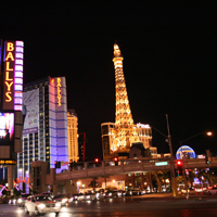
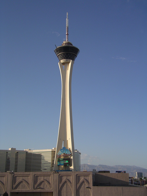
Despite its location outside the city limits, the Strip’s cityscape has formed the city’s identity and made it one of the most popular destinations for tourists. It includes a multitude of themes, including tropical waterfall, Egyptian pyramid, French cafes and Eiffel Tower, and music and circus, in addition to the modern hotels, casinos, restaurants and residential high-rises.

Nevada was the first state to legalize casino-style gambling. Gambling was forbidden in 1910 by law, but illegal-but-accepted gambling flourished until 1931 when the Nevada Legislature approved a legalized gambling bill. The legalized gambling legislation was designed to raise needed taxes for public schools. Today more than 43 percent of the state’s general fund is fed by gambling tax revenue and more than 34 percent of the state's general fund is pumped into public education (Las Vegas Chamber of Commerce, 2010).

The El Rancho Vegas, the first casino on the Strip, opened on April 3, 1941. The success of the casino triggered a small building boom in the late 1940s.In 1946, Bugsy Siegel opened Flamingo Resort. The first Las Vegas prototype resort, it was a combination of a luxury hotel, name entertainment and gambling. The Flamingo was followed by the Sahara, the Sands, the Tropicana,the Showboat, the Riviera and several other casino resorts. By 1954, over 8 million people were visiting Las Vegas each year (Manning and Samuelson 2008).

 New York, New York Hotel & Casino Source:MIG

In 1976, casino-style gaming was legalized in Atlantic City, New Jersey. This hastened the beginning of the era of mega-resorts in Las Vegas. Steve Wynn's 3300 room Mirage Resort opened in 1989, which set a new level to the Las Vegas experience by offering entertainment, free volcano shows, and dining options as well as gambling and lodging. This became the model for Las Vegas resorts in the 1990's, including The Dunes (present Bellagio Hotel & Casino),The Sands(present Venetian Resort), and the Aladdin Hotel (present Planet Hollywood Resort & Casino). Today the Las Vegas Strip provides an Eiffel tower replica, the New York City skyline in miniature, a glass pyramid and other visual wonders, which attract over 37.5 million visitors each year (Las Vegas Convention and Visitors Authority 2011). The development of these large, themed resorts diminished the success of the smaller hotels and casinos.

To attract visitors of all ages, resorts offered more youth-oriented attractions, such as MGM’s amusement park and Treasure Island’s video arcade. Yet it had limited success—the amusement park had to close due to a lack of interest. In 2009, the $ 8.5 billion CityCenter project was completed aiming to attract more visitors and create more jobs.

Theme Parks and Visual Impacts

The scale of hotel casinos and eclectic themes, such as Egyptian, tropical, and Venetian, create a sense of visual amusement and provide varied sensory experiences, including music, food, gaming and rides. Studies of the themed space suggested that sensory phenomena play a critical role in the construction of theming (Lukas 2007).

Pedestrians Source:MIG

Transportation and Access

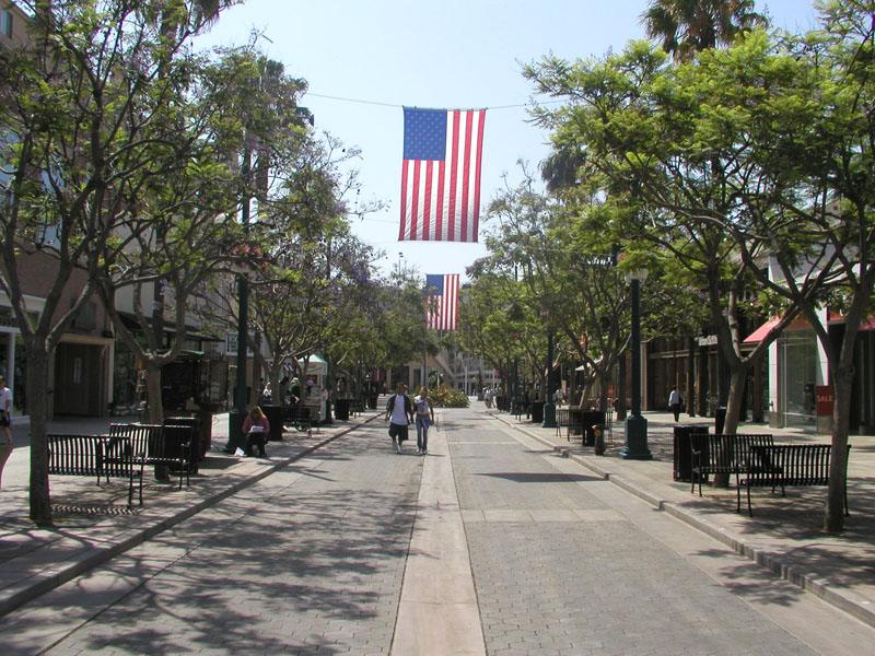
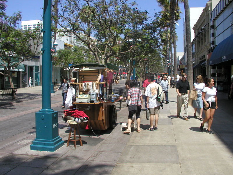
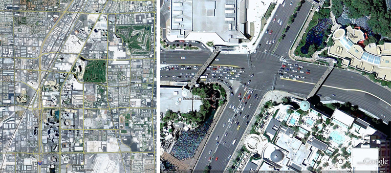
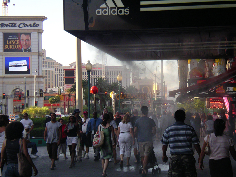
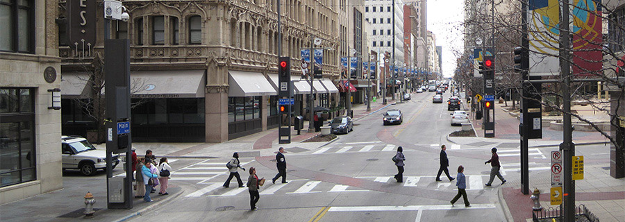
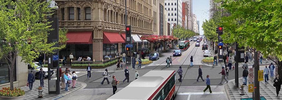
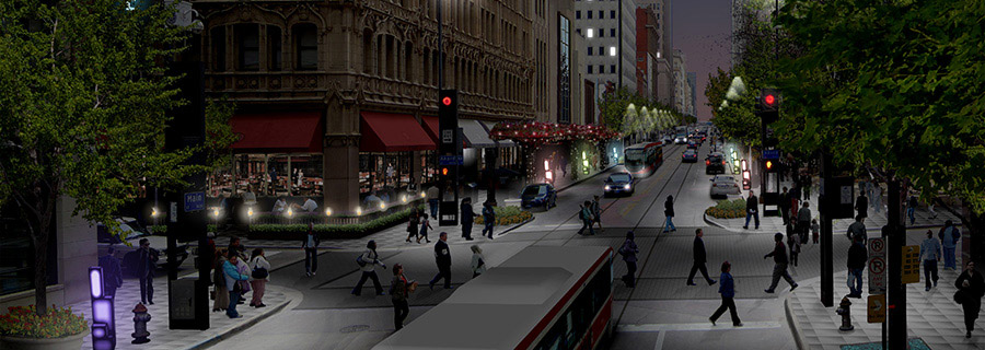
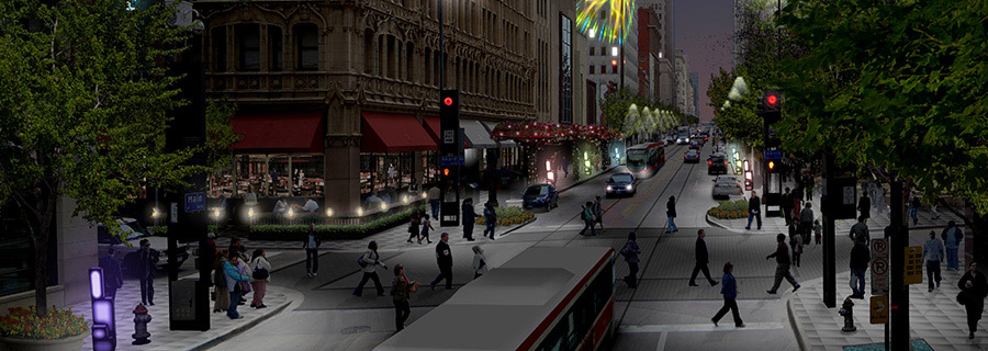
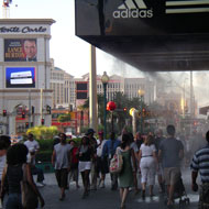
To access the incredible visual attractions, the Strip provides free shuttles and a convenient monorail and bus system for visitors. However, walking along the sidewalk can be challenging for pedestrians. The boulevard width varies from 80 feet to 135 feet, and it is often congested with heavy traffic. The traffic volume at Sahara Avenue and Las Vegas Boulevard was 83,838 on September 16th, 2010 (City of Las Vegas). There are several footbridges at popular intersections to alleviate traffic issues and help pedestrians safely traverse the roads, but sometimes pedestrians are forced to cross 10 travel lanes to reach the opposite side of the street. Most footbridges link hotels, forcing pedestrians to walk through casinos or shopping corridors. It is helpful for pedestrians to walk into the air-conditioned hotel and take a rest in the hot weather, but the lack of direct route and wayfinding can make pedestrians walk unnecessarily longer or get lost due to confusing layouts in casinos.

Lessons Learned
Potential Benefits

  • The visual amusement and various sensory experiences from the themed hotel casinos create a unique memory.

Potential Issues

  • Pedestrian access: The heavy trafficked roads and the lack of trees make pedestrians feel unsafe when walking along the sidewalk.
  • Shade: It is more challenging to walk on the sidewalk in the summer when there is a lack of shade from trees or shop awnings. Temperatures may be over 100 degrees in Las Vegas.
  • Footbridges: The footbridges help pedestrians cross intersections safely, but sometimes the bridges force people to walk into casinos, instead of letting them take efficient, direct routes.

Sources

City of Las Vegas.“History” (http://www.lasvegasnevada.gov/FactsStatistics/history.htm)

Las Vegas Chamber of Commerce, 2010. (http://www.lvchamber.com/visiting-las-vegas/facts)

Las Vegas Convention and Visitors Authority, 2011. (http://www.lvcva.com/index.jsp)

Manning, M. and Samuelson, A., May 15, 2008. “A Gamble in the Sand” Las Vegas Sun (http://www.lasvegassun.com/news/2008/may/15/mammoths-mobsters-infinte-amounts-money/)

Lukas, S, 2007. “Theming as a Sensory Phenomenon: Discovering the Senses on the Las Vegas Strip” in Scott A. Lukas. The Themed Space: Locating Culture, Nation, and Self. Lexington Books

Photo Sources

MIG, Inc.

Case Studies
Las Ramblas
Barcelona, Spain
categories
benefits
beautify streetscape, 
build community, 
improve environment, 
prevent violence, 

Background

Las Ramblas Aerial Source: Google Earth 2011

Las Ramblas is a .75-mile long, tree-lined pedestrian mall in Barcelona's Gothic Quarter. The wide boulevard begins at the city's main square, Plaza Catalunya, and ends at the Christopher Columbus monument at Port Vell.

The Ramblas consists of five pedestrian-oriented streets: Rambla de Canaletes, RambladelsEstudis (or RambladelsOcells), Rambla de SantJosep (or Rambla de les Flors), RambladelsCaputxins, and Rambla de Santa Mònica.

Las Ramblas Aerial Source: Simon Steel

In the medieval era, Las Ramblas was a riverbed just outside of the city walls. By the 15th century, the city had expanded across the river, changing the characteristics of Ramblas. In 1856, the remnants of the old city wall were torn down. The central pedestrian promenade of Las Ramblas has remained the same since.

The Ramblas used to be the space where everyone could stroll and spend their leisure time. Because of its central location, the Ramblas became a meeting place for all the social classes and is now a tourist attraction. Las Ramblas is a boulevard with a 36- to 80-foot wide pedestrian strip down the middle. Sidewalks are usually less than 10 feet wide, encouraging walking in the center. On each side of the strip, there are one or two lanes of traffic with a lane for parking and deliveries. This reserves the center of the street for pedestrians and the side traffic lanes for autos, reversing the usual relationship between pedestrians and vehicles.

The street width, building height and landscaping work together to create a pedestrian-friendly environment. The street is lined by five- to seven-story buildings with complex facades, textures and ornamental details. There are many entrances–almost every 13 feet–and windows create a sense of transparency to view of what is inside (Jacobs 1995). Large London plane trees, spaced less than 20 feet apart, create an interweaving canopy. The canopy filters light in the hot summer and also gives protection from the one-way traffic on either side. The building heights permit sun on the central promenade during the winter.

The central promenade is usually full of retail pushcarts, sales kiosks, and arts and crafts exhibitions. There are ample sitting areas. Some of the paving was decorated by the artist Joan Miró. There are several interesting destinations along and adjacent to the street, such as La Boqueria (the city's largest market), Plaza Reial, museums and a theater. Moreover, the street has its own program of events by permitting performances by local artists and musicians. Its visual and cultural landscape is different with every visit.

Adopted from: Jacobs 1995; Jimenez, A. et al.

Lessons Learned
Potential Benefits:

  • Comfort and Image
    • The pedestrian-prioritized street and the harmony between street width, building height, landscaping and intensity of usage create a pleasant pedestrian experience.
    • A mix of activities promotes diverse images and characters of the area.
  • Uses and Activities
    • Pedestrian promenade and sitting area for people-watching, discussions, and entertainment.
    • Retail and market space, including restaurants, eateries, and bars.
    • Exhibition space, festivals, bazaars, and demonstrations.
    • Cultural institutions, museums, and monuments (Columbus statue, Canaletas fountain).
  • Access and Linkage
    • Major thoroughfare connecting central city plazas with waterfront by way of Gothic quarter.
    • Prioritized pedestrian access from central promenade.
    • Walkable along entire length (less than one mile).
    • Metro access.

Adopted from: Project for Public Spaces, 2003

Potential Issues

  • Design consistency: Allan Jacobs noted in his book, Great Streets, that the newly installed street lights do not match the existing street lights and other facilities, disturbing the original characteristics of the street.

Sources

Alex-Ricardo Jimenez and Zhan Guo. “Case Study on Las Ramblas, under the direction of Thomas Piper of the Dept. of Urban Studies and Planning” (http://www.boston.com/beyond_bigdig/cases/barcelona/index.shtml)

Jacobs, Allan B., 1995. “Great Streets” MIT Press

Project for Public Spaces, 2003. (http://www.pps.org/great_public_spaces/one?public_place_id=59)

Photo Sources

MIG, Inc.

Case Studies
The Avenue des Champs Elysees
Paris, France
categories
benefits
beautify streetscape, 
build community, 
improve environment, 
slow traffic, 

Background

Champs Elysees Aerial Source: Google Earth 2011

The Champs Elysees is the thoroughfare that runs through the heart of Paris and links the southeast to the northwest of Paris. It is a 1.2-mile long and 230-foot wide major road that runs from Place de la Concorde to Arc de Triomphe (Paris Digest). The avenue consists of two different sectors: the intensely developed northern part, from the Rond-Point to the Place de I’Etoile, and the well-landscaped southern part, from the Place de la Concorde to the Rond-Point. This grand boulevard has approximately 70-foot wide sidewalks (which sometimes include 22-foot wide access roads) and double rows of street trees to buffer pedestrians from traffic. But crossing 10 travel lanes (approximately 87 feet) is challenging for pedestrians. The average daily traffic volume is about 84,000, with an average of 10.67 accidents per year per intersection (Jacobs1994).

Champs Elysees Aerial Source: Google Earth 2011

Because of its proximity to several Paris landmarks such as the Arc de Triomphe, the Champs Elysees has been a venue for several famous military parades and public events. On Bastille Day, the largest military parade in Europe passes down the Champs Elysees. Each year from the end of November to end of December, the Champs Elysees Committee contributes to the lighting of the Champs Elysees for the holiday season.

Adopted from: History of Avenue des Champs Elysees

The Champs Elysees originally consisted of market gardens, fields and swamplands on the outskirts of Paris. In 1616, Marie de Medici, a queen consort of France, decided to extend the garden axis of the Palais des Tuileries (a royal palace in Paris) with an avenue of horse-chestnut trees. In 1724, the Tuileries garden axis and the avenue were extended, leading beyond the Place de l'Etoile. By the late 1700s, the Champs Elysees had become a fashionable avenue and the trees on either side had thickened. In 1828, the Avenue des Champs Elysees became city property, and sidewalks, fountains and street lighting were added. By the 1860s, when Baron Georges Eugene Haussmann was giving Paris its present shape, the Champs Elysees had become a center of cafes, hotels and luxurious homes. However, the prosperity of the 1960s attracted airline companies, car dealerships, fast-food restaurants, panhandlers and badly parked cars. Rents plummeted and many commercial spaces stayed empty.

Adopted from: Riding 1990

In 1990, Jacques Chirac, the mayor of Paris, began a $45 million project to redevelop the historic zones and public spaces. According to Barbe, the aim of the redevelopment was to “renew a grand promenade popular with Parisians, the French people and foreigners by once again giving it an urban quality, a dignity and a life which it had lost (Barbe 1995).”

The main elements of the redevelopment of Champs Elysees included (Pearce 1998):

  • Enhancing the perspective of the avenue by removing curbside car-parking and creating a new 850-space underground car park.
  • Widening the sidewalks.
  • Planting a second row of trees.
  • Reducing and realigning the street furniture, such as streetlamps and bus stops.
  • Upgrading the shop frontages by new regulations governing publicity, signs and terraces.
  • Changing the land use zoning (plan d’occupation des sols) to encourage the return and development of such functions as hotels and cinemas that generate some of the activity for which the avenue was previously known.

What Makes Champs Elysees a Great Place?

Comfort and Image

  • Extra-wide sidewalks provide adequate space for cafes and vending.
  • Continuity of trees and lighting scales down the expanse of the sidewalk.
  • The alley of trees along the curb buffer pedestrians from the automobile traffic.
  • There are few benches on the Champs Elysees, but many restaurants and cafes provide outdoor seating.
  • Plantings, coverings and shade enhance outdoor seating experiences.
  • Sidewalk amenities include colorful banners, cast-iron kiosks with displays, ornate street lamps and interesting sidewalk patterns.

Uses and Activities

  • Most people walk on the sunny northside, where there are more cafes, theaters, chain stores and boutiques.
  • Fewer stroll on the south, where there is less sun and more banks and luxury restaurants.
  • Activity does not decline after dark; the street is well-lit and takes on a new ambiance of nightlife.

Adopted from: Project for Public Spaces

Shopping and Tourism

The Champs Elysees is a great 30-minute walk from Champs Elysees Clemenceau metro station (line 1) to Arc de Triomphe and Charles de Gaulle metro station (line 1). It is also the top Paris shopping district with 500,000 visitors daily. Many famous French and international brands have their flagship stores along the corridor. There are luxury shops and hotels, such as Cartier, opened in 2003, Louis Vuitton’s five-story flagship store, and the Fouquet’s Barrière hotel, where the least expensive room is nearly $900 a night. Louis Vuitton is so popular that its customers — most of them tourists — often line up outside for entry (Sciolino 2007).

The Champs Elysees is one of the most expensive avenues in the world, and this causes a loss of small, local stores in the area. With rents as high as $1.2 million a year for 1,000 square feet of space, the Champs Elysees is the most expensive strip of real estate in Europe, and the third most expensive in the world after Fifth Avenue in New York and Causeway Bay in Hong Kong (Sciolino 2007). As such, only global chain stores can afford the rent, and most of the music clubs and movie theaters are closing. The avenue progressively is losing its exceptional and symbolic character, thus its attractiveness. The City tries to push back by stopping the opening of international stores and providing annual subsidies for old, local businesses. For example, the H&M clothing chain was not permitted to open a store on the Champs Elysees in 2007.

Lessons Learned
Potential Benefits:

  • Increases the city’s tourism industry.
  • Enhances the pedestrian experience. The double rows of trees, widened sidewalks, outdoor seating and cafes on the sidewalk contribute to memorable walking experience.
  • Provides for safe nightlife. The street is well-lit and creates a new ambiance of nightlife.

Potential Issues:

  • High rents: The continued success of the street has led to high rents, which is causing the loss of its small businesses and thus the street’s original identity.
  • Maintenance: The street requires constant maintenance to keep the corridor safe and clean. Police officers and street cleaners keep eyes on the street to make it safer for its visitors and compensate for a lack of trash cans.
  • Street crossing: Crossing wide, heavy trafficked roads is challenging for pedestrians.
  • Shade vs. visibility: The London plane trees, spaced at about 30 feet, were pruned too high above ground level, and thus do not provide appropriate shade and visual protection from the traffic. However, they do allow greater visibility of businesses.
  • Pedestrian access: The outdoor dining and kiosks on the sidewalk sometimes block the pedestrian flow.

Sources

Barbe, C., 1995. “La Rehabilitation des Champs Elysees (mimeo).” Paris: Direction de l’Amenagement Urbain

History of Avenue des Champs Elysees (http://www.placesinfrance.com/history_des_champs-elysees.html)

Jacobs, Allan B. et al., 1994. “Boulevards: A Study of Safety, Behavior, and Usefulness” Working paper. UCTC No. 248,

Paris Digest, “Champs Elysees Facts”(http://www.parisdigest.com/promenade/champselysees.htm)

Pearce, Douglas G., April 1998. “Tourism development in Paris: Public intervention” Annals of Tourism Research, Volume 25, Issue 2,Pages 457-476

Project for Public Spaces (http://www.pps.org/great_public_spaces/one?public_place_id=105)

Riding, Alan,1990. The New York Times (http://articles.sun-sentinel.com/1990-01-23/news/9001200676_1_champs-elysees-champs-elysees-fast-food-restaurant).

Sciolino, Elaine, Jan. 31, 2007. “Megastores March Up Avenue, and Paris Takes to Barricades,” The New York Times (http://www.nytimes.com/2007/01/31/world/europe/31paris.html?pagewanted=all)

Photo Sources

MIG, Inc.

product name

Your Product Name Here

manufacturer

product description

categories
before
after
after
Insert
see Image and Identity Best Practices
01
Insert
see Image and Identity Best Practices
01
Bicycle Paths
see Mobility and Access Best Practices
10
Featured Product:
Your Product Name
show product details
after
Insert
see Image and Identity Best Practices
01
Insert
see Image and Identity Best Practices
01
Bicycle Paths
see Mobility and Access Best Practices
10
Featured Product:
Your Product Name
show product details
after
Insert
see Image and Identity Best Practices
01
Insert
see Image and Identity Best Practices
01
Bicycle Paths
see Mobility and Access Best Practices
10
Featured Product:
Your Product Name
show product details
after
Insert
see Image and Identity Best Practices
01
Insert
see Image and Identity Best Practices
01
Bicycle Paths
see Mobility and Access Best Practices
10
Featured Product:
Your Product Name
show product details
after
Insert
see Image and Identity Best Practices
01
Insert
see Image and Identity Best Practices
01
Bicycle Paths
see Mobility and Access Best Practices
10
Featured Product:
Your Product Name
show product details
Image and Identity
Learn more about
Image and Identity...

The development of street image may be defined as preserving, creating, enhancing and expressing the unique character of the street and the surrounding area through streetscape elements, architecture and visual place-making features.
Layers of history, architecture of buildings and private realm land uses all contribute to creating a unique identity for a street. However, this topic focuses on how the place making and design of the street realm can help create an identifiable street.

The shape and character of most iconic streets that developed in the 20th century were formed primarily to serve the automobile and the pedestrian realm was of secondary importance. In looking at the old, historic streets of Europe and Asia and the more recent examples of iconic streets in America, Europe and Asia we see that a strong pedestrian environment is critical to image and identity and establishment of a strong sense of place. These streets are clearly serving residents and visitors, are thriving commercial successes and are encouraging local pride and public stewardship.

The Need for Image and Identity
Iconic streets imbued with a lasting image and grounded sense of place is essential component to all urban and rural cities and towns. Not all streets can have a regional or city-wide iconic identity, however some streets take on that role of telling the story of the area and the larger region it represents. Iconic streets have a magnetic quality that attracts people, business and commerce that makes them natural and appropriate venues for public events. The scale and character of these streets distinguish them from others to make the most significant examples beacons of community pride and ownership. In today’s world of mass produced product and culture, streets with special identity stand out in their ability to contribute to a community’s need to recognize and celebrate its own distinct historic social and cultural heritage, and natural environmental context.


Streets designed for image and identity should aim to meet the following overall goals:

  • Establish an identity that reflects the aspirations of the immediate community and describes the larger neighborhood or district.
  • Reinforce and enhance the tangible and intangible connection to the local social, cultural, physical (manmade and natural) and where applicable historic context.
  • Develop pride and ownership for the local residents and workers who will help maintain the street.

Streets designed for image and identity should include a diversity of activities including but not limited to:

  • Identifying
  • Interpreting
  • Viewing
  • Expressing
  • Informing
  • Orienting
  • Consuming – eating, drinking, shopping, etc.
  • Browsing, window shopping
  • Socializing
  • Lounging, people-watching
  • Performing
  • Dancing
  • Other

The following image and identity street types can be supported and facilitated through the design of the street environment:

  1. Downtown main streets, as the original historic commercial mixed-use traffic street continue to be a major thoroughfare for the city, but also function as an important work center, public gathering space, administrative core and shopping destination. Clearly marked and signaled crosswalks and intersections, high quality furnishings and streetscape plantings.
  2. Neighborhood main streets are a smaller-scale form of downtown main streets that are characterized by walkable services, cafes, pubs, and locally-owned retail most easily accessible to residents living within a 1/4 to 1/2 mile radius. Simplified street layout, few traffic lanes, marked crossings and street furniture characterize this type.
  3. Arts and cultural entertainment districts showcase the intermingling of artist galleries and studios, and cultural and entertainment destinations. These districts may choose unique signage, paving design, murals or on-street installations to communicate what is offered there. Often, these districts are expressions of a city’s desire to diversify its economic base and create venues for cultural expression through physical revitalization, investment and implementation of sponsorship programs that help sustain and make artists more visible.
  4. Historic districts are collections of buildings, properties, sites and streets that help define the historical character of a place. They can be residential, commercial, industrial, etc. in nature. Emphasis is usually on built period structures, but typically there are also street furnishings, streetscape materials and landscape elements that reflect the historic character. Historic districts protect buildings, properties and other features from owner-initiated alterations that denigrate the holistic physical integrity of the district's features.
  5. Industrial districts have distinctive buildings types, flexible formats and larger scaled streets that respond to the transport, manufacturing and distribution functions of industrial urban commerce, often in conjunction with major transportation infrastructure such as rail yards, highway onramps or waterfront port facilities.
  6. Residential neighborhood streets, supporting the needs of single-family, multi-family, townhome and other residences. Simple street layout, slow moving and low traffic volumes, and family friendly street furniture characterize this type.

A combination of elements and amenities are essential to creating streets with an iconic identity. Some support business activities themselves, and some provide a comfortable environment for pedestrians.

  1. Structures – gateways, memorials, water fountains, etc. Structural features such as gateways, monuments, memorials and water fountains (where climatically and environmentally appropriate) function as navigation landmarks along a street. Structures share contextual information with uses - through materials, method of construction, design and fabrication - which to provide enhanced understanding of the urban environment presented at the street level.
  2. Banners and flags – Decorative and identifying banners and flags display a range of cultural, political and social cues, symbols and icons significant to the street's audience.
  3. Signs and posters – Directional, informational or promotional in nature, signs and poster displays direct people to key locations and help to orient people to events that are scheduled to take place on the street or at nearby locations.
  4. Shelters – Structures that provide people protection from the elements, noise, and traffic. They can be designed to become a place of respite from the crowds or active place for activities such as picnicking. They also can provide information and in the case of transit shelters indicate access points to public transit available from the street. Shelters should have an appearance that strengthens the overall image and identity of the street.
  5. Planting – trees, shrubs, grasses - Landscape arrangements at the streetscape level include trees, shrubs and ground cover plantings in medians or sidewalks, and vegetated rain gardens and bioswales/detention planters.
  6. Seating – Seating elements along a street can include a variety of benches, table seating with movable chairs, seat walls, art elements and planting containers. Seating features welcome and invite people to linger on the street. Seating should receive regularly scheduled maintenance to ensure safety and quality appearance while discouraging loitering and attracting undesirable elements.
  7. Art (community, functional, abstract) – Art plays an important role in streets to bring beauty and interest and provoke dialogue among users of the site. Art includes two-dimensional painting or mosaics, or three-dimensional sculpture, and can be integrated into street furniture such as benches, trash receptacles, lighting hardware, landscaping or parking. Art maybe public, or provided by private property owners.
  8. Murals – Murals function as visual narratives of a neighborhood or street's cultural or social history, often using bright colors, symbols and other elements reflective of the resident or emerging culture. Murals can be commissioned pieces or spontaneous projects with little planning, but they generally are created with the assistance, input and feedback of the community.
  9. Lighting – Street lighting comes from diverse sources of fixtures - illuminated pavement, lit bollards, overhead street lighting, gas lamps, other pedestrian-scaled lighting elements often with pendant fixtures and other decorative details. The type of lighting on a given street is reflective of the major function and audience it will serve (urban and rural), and should address pedestrian safety.
  10. Digital displays  – Digital displays are useful when the nature of information provided on a street changes rapidly or without notice. They can be installed on the sides of buildings, within kiosks, on the ground, as part of a gateway structure and at building entrances, etc.
  11. Sound  – Audible advertisements notices, directions, etc are often used on streets at crosswalks, at transit stops and at street entrances to buildings.
  12. Smell – Olfactory elements that assist people in one of the most powerful ways as the sense of smell is the strongest sense. It can be incorporated in naturally scented trees, flowers and herbs, as well as outdoor displays and activities such as outdoor dining, stands of fruits and vegetables, etc.
  13. Play features – Child and adult friendly recreational features such as climbing wall, play equipment, etc.
  14. Amenities – Basic amenities such as water fountains for humans and dogs, bike parking, etc. that are preferably custom-designed to strengthen the overall image of the street.

Pages

Subscribe to RSS - Image and Identity