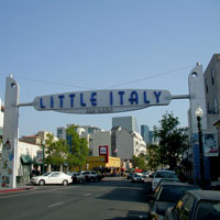
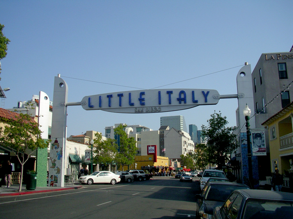
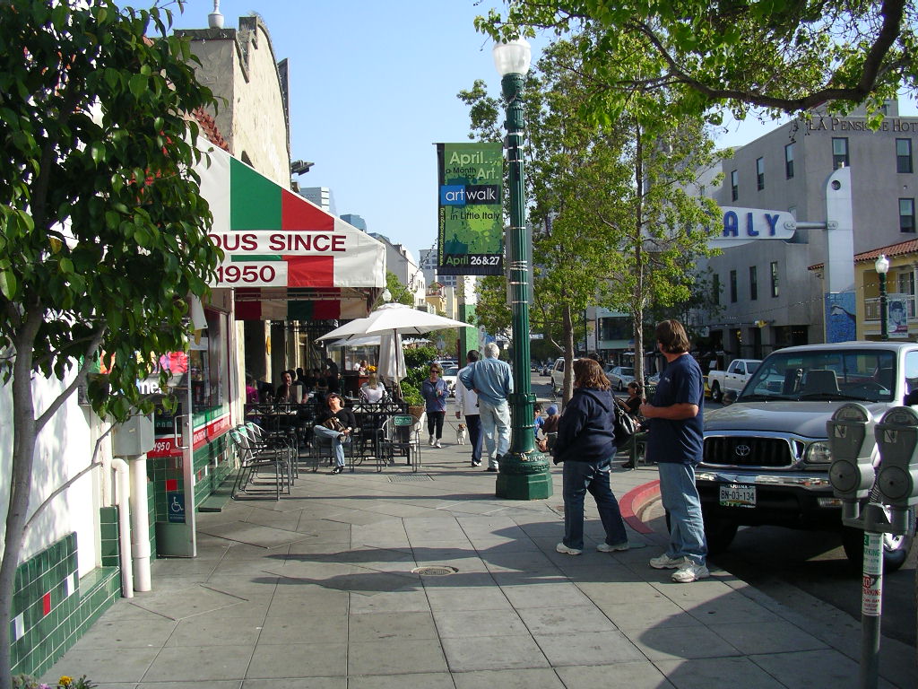
Originally a predominately Italian fishing neighborhood, Little Italy is a thriving neighborhood in Downtown San Diego, California. The scenic neighborhood includes Italian restaurants, Italian retail shops, home design stores, art galleries and residential units.
A fairly easy walk, San Diego's Little Italy is over 48 square blocks filled with rich Italian culture, which allows visitors to absorb the people, sights and overall atmosphere. India Street, the thriving commercial corridor, runs straight through heart of Little Italy, intermingled with high-density mixed-use buildings and single-family bungalow-style historic properties. A trolley provides easy connection between Little Italy and the Santa Fe Train Depot, the American Plaza trolley transfer station and the Old Town Transit Center. Little Italy is located in close proximity to San Diego International Airport.
Historically, Little Italy was the home to Italian fishermen and their families. Many Italians moved to San Diego from San Francisco after the 1906 San Francisco earthquake in search of tuna and other deep-sea sport and commercial fish. When Interstate 5 was constructed through Little Italy in the early 1970s, 35% of the neighborhood was destroyed. During the same time, the California tuna industry was declining, which caused the neighborhood to suffer nearly 30 years of decline. At that time, the neighborhood was mainly composed of low-density commercial businesses and single-family detached homes.
With the creation of the Little Italy Association in 1996, the neighborhood has gone through gentrification and has seen a renaissance as a Community Benefit District. Its Italian food, boutique shopping and high level of street maintenance makes this shopping district the place to live in Downtown San Diego. Currently, the neighborhood is mainly composed of residential units – mostly mid-rises, high-rises and lofts – with ground floor retail stores and a few commercial buildings.
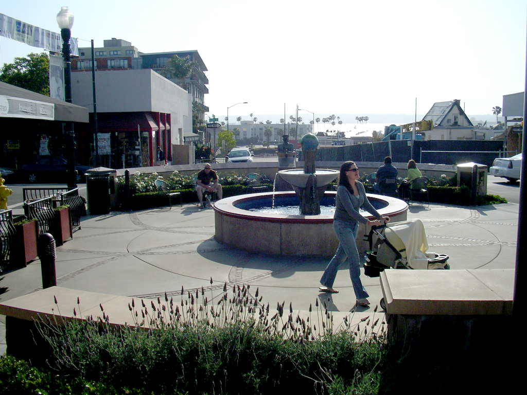
There are multiple public improvements and high-rise and mid-rise buildings under construction or scheduled for construction. Although many of the buildings have been renovated, the new buildings duplicate the same feel of the original establishments with huge archways, outdoor dining and ample vegetation that make visitors feel as though they have walked straight into Italy. During special events, many family-owned restaurants let visitors try their specialties. All along India Street, public art and various Piazzas invite visitors to stop and take in the San Diego sun.
Revitalization
Formation of a Business Improvement District (BID) during the 1990s, run by the private, nonprofit Little Italy Association, was a key factor in the area’s rebound. The association also runs a Community Benefit District (CBD). The Business Improvement District is funded through business tax licenses in the area and generates $90,000 a year. The Community Benefit District generates $750,000 a year through property assessments. The money from the BID and the CBD are used for maintenance and neighborhood security.
From eleven Italian-related businesses in the mid-1990s, Little Italy has grown to become home to 19 Italian restaurants, 22 home furnishing stores and 11 art galleries. The Centre City Development Corporation (CCDC) provided more than $4 million for many of the capital improvements to the streetscape. Improvements included upgrade and replacement of existing surfaces with particular sensitivity to retaining the original character along India Street, landscape, lighting and parking improvements as well as traffic circulation improvements and upgrades. The Little Italy Association provides maintenance funding for the trees, trashcans, landscaping and new sidewalks. The CCDC has also subsidized construction of 16 row houses, 12 affordable rental lofts and 37 low- and moderate-income apartments on a block of land the CCDC purchased. Currently the most common complaint is that an area once covered with parking lots is now one of the most difficult places to park in all of San Diego.
Adopted from: Shigley 2008
Other improvements have included:
Revitalizing the C Street corridor from India Street to Park Boulevard to make it safer for pedestrians, more conducive to private development and business, and more efficient for trolley riders.
Implementing the Trolley Renewal Project that focuses on repairing the nearly 30 year-old Blue and Orange lines, which are well beyond their life expectancy. The project includes installing low-floor trolleys, tracks and station platforms; replacing old rail and overhead wire; and improving switching, signaling and crossovers. The complete overhaul of transportation and pedestrian traffic flow is expected to be completed by 2015.
Developing the Piazza Basilone at the southeast corner of Fir and India, which will transform half of Fir Street into the Piazza. The Piazza is strategically located at the bottom of Fir Street, allowing the street to be closed off for special events.
Creating Amici Park, an approximately 50,000 square foot park in a formerly blighted corner of downtown bounded by Date Street and Interstate 5. The park is now shared by the community and Washington Elementary School.
Establishing a parking district that allows meter fees to be retained to benefit parking projects in Little Italy. Over 20 years, this revenue is anticipated to be almost $2 million.
Community Events
Year-round community events are held in Little Italy, and the majority are related to Italian culture. Most of the events center on and around India Street, usually bordered by Grape Street to north and Beech Street or Ash Street to the south. Some of these include:
Little Italy Mercato: An Italian farmers’ market held every Saturday on Date Street features freshly caught fish, vegetables and fruit from local farmers, pastries from local bakeries and art from Little Italy’s artists.
Little Italy Carnevale: A Venetian mask event held before Mardi Gras with entertainment and an open house for retail shops and restaurants.
ArtWalk: The largest art event on the west coast is held each April with over 120,000 people attending. It includes art, jewelry, furniture and more.
Gran Fondo (Big Ride) Colnago San Diego: Over 3,000 bicycle riders from all over the world come to ride throughout “America’s Finest City” in a 32-, 53- or 100-mile ride that starts under the Little Italy’s landmark sign.
Labor Day Stickball Tournament: Several stickball leagues come to play on the streets of Little Italy in this time-honored east coast game that is played like baseball. Every three years, the San Diego leagues host a West Coast Invitational where they invite New York and Puerto Rico to play on the streets of San Diego’s Little Italy.
Little Italy Festa: The largest Italian festival outside of New York City occurs in Little Italy in October. It includes over 150 Italian food and craft booths, three stages of entertainment, the Gesso Italiano Street Painting Festival, a stickball exhibition game, bocce ball tournament, and beer and wine gardens.
Little Italy Christmas Village and Tree Lighting: This holiday event occurs each December.
In addition, a number of food events, such as Festivale Siciliano and a Taste of Little Italy occur throughout the year.
The Italian Community Center of San Diego, a 500 member nonprofit organization founded in 1981 for people interested in Italian culture and language, also is located in the Little Italy neighborhood.
Lessons Learned Potential Benefits:
Leverages dedicated funding sources to implement improvements and provide maintenance.
Builds on the neighborhood’s historic character.
Utilizes mixed-use development to create a constituency for services.
Expands pedestrian and social gathering spaces.
Provides good linkage to transit.
Hosts unique year-round events that are primarily tied to the neighborhood theme.
Potential Issues:
Phased improvements: The neighborhood required improvements which were phased-in over several years.
Community support: The support of businesses and the community is needed.
Shigley, Paul, October 29, 2008. “In Shadows Of Downtown, SD’s Little Italy Thrives Again”
California Planning and Development Report (http://www.cp-dr.com/node/2169)
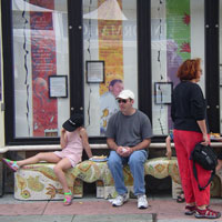
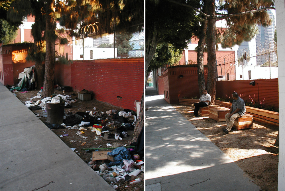
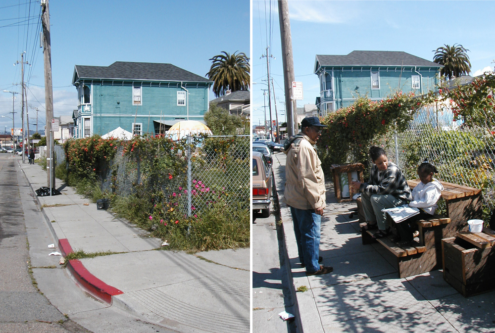
“Outdoor Living Rooms are vignettes of furniture installed in public spaces – simple wood fixtures that give physical form to the social life of the street: waiting for a bus, meeting outside a shop, chatting or playing a game or just lounging. Steve Rasmussen-Cancian works with residents in low-income neighborhoods in West Oakland and parts of Los Angeles, where officially sanctioned and funded improvements are hard to come by.
The West Oakland Greening Project created the first outdoor living rooms with found furniture: discarded sofas repurposed as sidewalk seating. Their later iterations have been custom-made out of simple materials to recreate the park benches, front stoops and outdoor tables where a neighborhood's inhabitants have traditionally interacted with one another and created a community. At first the outdoor living rooms in West Oakland were regularly hauled away by officials, but more recently the city has informally accepted the installations and offered permits if activists would purchase liability insurance. In Los Angeles, local activists won full permitting for living rooms without fees or requirements to buy insurance, eventually drawing Mayor Antonio Villaraigosa to come build a bench.” – San Francisco Planning and Urban Research Association
Outdoor living rooms are similar to the San Francisco parklet concept, but are more appropriate for communities that cannot afford the infrastructure that parklets require.
Lessons Learned Potential Benefits:
Provides designated public gathering spaces in a neighborhood.
Reflects the needs of the community.
Is appropriate for both residential and commercial streets.
Potential Issues:
Cost: Although low cost, the cost of street furnishings could be an issue.
Maintenance: An agreement should be reached regarding who will maintain the living room.
Official intervention: In Oakland, a common problem has been that police take the furniture away.
Sources
Hammett, Kingsley. “Sidewalk Living Rooms”
(http://www.designerbuildermagazine.com/designerbuilder_sidewalk.html)
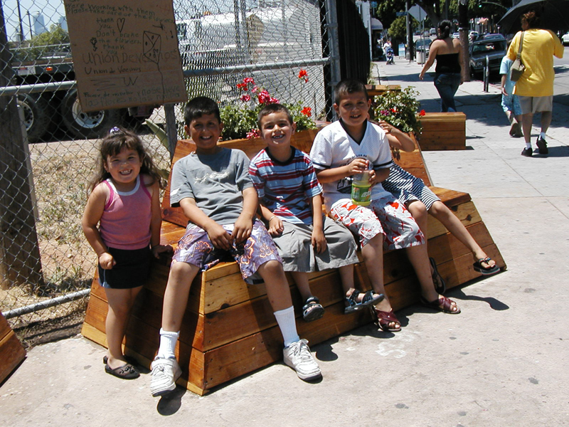
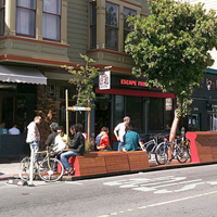
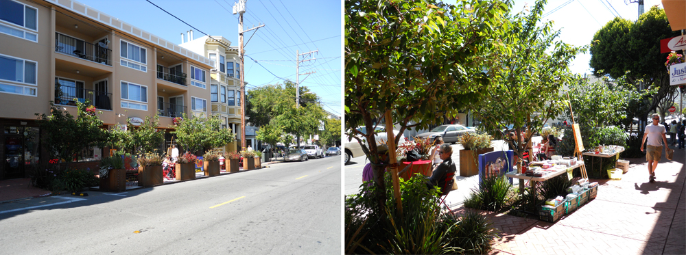
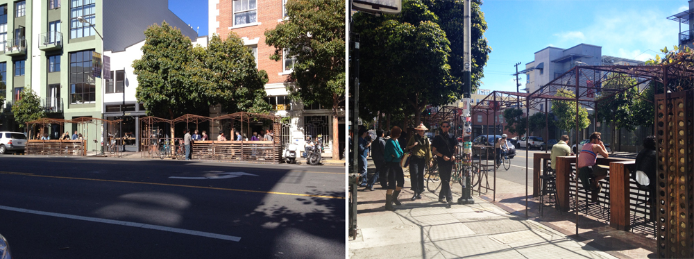
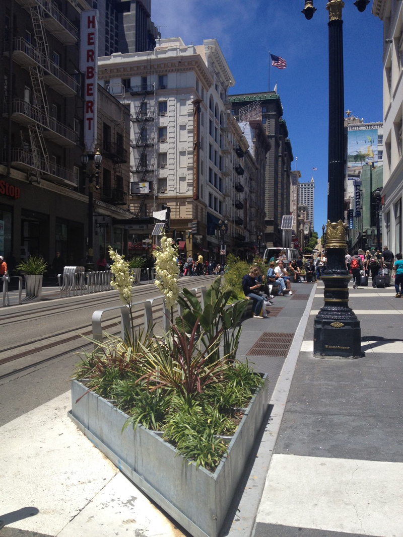
San Francisco’s streets and public rights-of-way make up fully 25% of the city’s land area – more space even than is found in all of the city’s parks. Many of the streets are excessively wide and contain large zones of wasted space, especially at intersections. San Francisco’s Pavement to Parks project temporarily reclaims these unused swathes, and quickly and inexpensively turns them into new public plazas and parks. During the temporary closure, the success of these plazas will be evaluated to understand what adjustments need to be made in the short term, and ultimately, whether the temporary closure should be a long-term community investment.
San Francisco’s Pavement to Parks projects are inspired by the recent success of similar projects in New York City, where plazas and seating areas have been created in excess roadway simply by painting or treating the asphalt, placing protective barriers along the periphery and installing moveable tables and chairs. Streets such as Broadway have been transformed into much more inviting and pedestrian-friendly spaces through New York’s efforts.
Each Pavement to Parks project is intended to be a public laboratory where the city can work with the community to test the potential of a selected location for permanent reclaiming as public open space. Materials and design interventions are meant to be temporary and easily moveable should design changes be desired during the trial run. Seating, landscaping and asphalt treatment are common features of all projects.
Locations for Pavement to Parks projects are selected based on the following criteria:
Sizeable area of underutilized roadway.
Lack of public space in the surrounding neighborhood.
Preexisting community support for public space at the location.
Potential to improve pedestrian and bicyclist safety via redesign.
Surrounding uses that can attract people to the space.
Identified community or business steward.
Pavement to Parks is a collaborative effort between the Mayor’s Office, the Department of Public Works, the Planning Department and the Municipal Transportation Agency. Each project requires partnerships for implementation. For example, the cost of the 22nd Street Parklet was paid for entirely through donations by San Francisco resident Mr. Jonathan Weiner and the three businesses fronting this Parklet.
Adopted from: Pavement to Parks
Lessons Learned Potential Benefits:
Provides flexible space, e.g., using moveable tables and chairs.
Increases space for outdoor dining, bike parking and landscaping.
Potential Issues:
Location selection criteria: Selection criteria must be met.
Collaborative effort: Projects require funding, volunteers and partnerships for implementation.
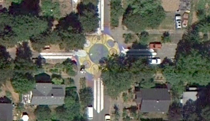
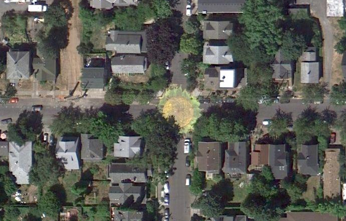
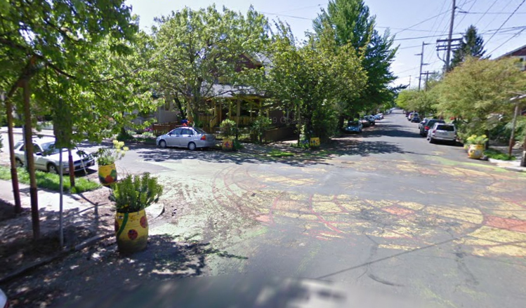
Share-it-Square is at Sherret Street and 9th Avenue in the Sellwood Neighborhood of Portland, Oregon. It was first constructed in 1996 for $65. Changes and improvements are ongoing.
Share-It Square was the first community-initiated and community-built project in Portland. When a group of Sellwood neighbors began building an unauthorized gathering space, a Portland city official’s response was, “That”s public space. Nobody can use it.”
Local residents, including Mark Lakeman, who went on to start City Repair, a local nonprofit that helps citizens design and build social gathering spaces in their neighborhoods, were primarily responsible for the design and implementation of this project.
“Our cities and places are no longer ours. We’re not building our own places; we’re not designing them to fit our own needs. Our lives are zoned like we’re a resource to be managed. We're housed here, and then this is where we work in order to pay for the housing we barely get to live in. Mixed use here. Monocultural use here. Parking garage. Maybe a waterfront here. Park. Park. It doesn't add up. None of them are really whole.” – Mark Lakeman.
The neighbors chose to transform an intersection, because a crossroads is a gathering place where people come together. “In America, our great archetype is the main street, which is not really a center. It’s just a flow. It’s a movement corridor, and you have to yell across the street because there isn’t a place in the middle. There isn't a social commons that you can attain and occupy.”
During the first project, the neighbors who lived around the intersection came out on the weekend, painted a design in the street, built all the structures around the corners–a bench, a lending library, a 24-hour tea stand, a children’s playhouse, a kiosk for sharing neighborhood information–and turned the intersection into an interactive social space.
Since then people have built saunas, put in gardens and helped each other paint their houses. Americans move every four to seven years, and that period of time is visibly lengthening right around that intersection because people want to live there. Families are clustering around it, having kids or bringing their kids, increasing the number of children in the neighborhood. There is more shared childcare and more adults interacting with kids on the street.
“New projects emerged over the years, as the intersection got repainted for about $500, which was raised by residents. People worked together. One neighbor built an earthen oven in the shape of her Australian tree frog, Oblio. It gets fired up for neighborhood pizza parties. Several neighbors went door to door and took 60 to 70 orders for fruit trees, huckleberry bushes, and other edible plants that will make the neighborhood a “fruitopia,” perfect for “grazing” as people walk through it.” – Mark Lakeman
Creation of the Square led to city adoption of the ordinance that allowed similar projects to be created. Portland’s ordinance requires that 80 percent of neighbors within two blocks sign statements approving the plan. After installation of Share-It Square, organizers surveyed their neighbors and found that an overwhelming majority (over 85% in each case) felt that crime had decreased, traffic had slowed and communication between neighbors had improved.
Sunnyside Piazza
Background
The Sunnyside Piazza is located at SE 33rd and Yamhill Street in Portland, Oregon. It was first constructed in 2001, built by local residents and City Repair.
In 2001, neighbors were complaining of noise, speeding, drugs, and abandoned cars. After a series of meetings and workshops facilitated by City Repair, they determined to paint a sunflower in the middle of the intersection, turning it into a piazza. One neighbor provided 28 gallons of paint. The city's street sweepers cleaned the intersection. Planter barrels were placed on either side of the four corners to keep people from parking in the piazza and to slow traffic down. Neighbors had a community gathering, complete with dancing and a visit from the winged T-Horse.
The next year, the city approved plans for trellises on all four corners, the first arches built over sidewalks in Portland since the stone gateways to Laurelhurst Park some 100 years ago. One neighbor, who had initially opposed the painting of the intersection, came up with the idea to plant honeysuckle in the trellises. Neighbors raised the money and did the work.
There have been a few acts of vandalism, but nothing serious. “Some kids have ‘laid rubber’ in the middle of our intersection, there’s often litter and one time someone pulled out the wiring in our kiosk.”
Jan Semenza, whose studies of public health have suggested that “urban planning processes may contribute to the epidemics of obesity, diabetes and depression that are sweeping the United States,7rdquo; has assigned his students to study neighborhood reactions to the Sunnyside Piazza over time, and to compare crime and other statistics with those at comparable unimproved intersections in demographically parallel neighborhoods. After more than 700 interviews, they concluded that 65 percent of Sunnyside Piazza-area residents rated their neighborhood an excellent place to live, compared with 35 percent at another similar but unimproved intersection. Also, 86 percent of Sunnyside neighbors reported excellent or very good general health, compared with 70 in the adjacent neighborhood. And 57 percent versus 40 percent said they felt “hardly ever depressed,” even in Portland's rainy weather. Calls for police services have decreased since the intersection repair.
Additional City Repair Projects
In 2010, there were 200 major sites and almost 300 little projects that have been built in Portland and around the state.
“Some of them are really simple things. Like, there’s this wonderful intersection that has a painting of an oak tree, in honor of a tree that used to stand there. Everyone called it Ruth’s tree after their neighbor, who had planted it when she was a little girl. When she was in her 90s, she died. Shortly after, the tree fell over into the intersection. So the community comes out and paints this huge effigy of the tree, right there. Then there’s the T-Horse, which is a mobile tea house–it travels around to different neighborhoods in Portland, and wherever it goes people gather to drink tea, or play Frisbee, or whatever. It’s a vehicle with enormous wings, so it really entices people out.”
“The Memorial Lighthouse is also beautiful. It’s a solar-powered pillar of cob that glows at night, decorated with bicycle wheels and mosaic stained glass. It was built in memorial to a bicyclist who was killed there by a truck. His mother and friends would bring flowers and gifts, and leave them in the place where he died. His mother would come and mourn him, just sitting there on the sidewalk. Finally the neighbors asked if one of the corners of the intersection–a corner of a person’s yard–could be turned into a memorial to him and a place for his mother to sit. So this beautiful celebration of his life was created. He was a bicycle activist, so there’s a strong bike theme.” – Mark Lakeman
At Southeast Eighth and Ankeny Streets, a shrine to the Virgen de Guadelupe was conceived, designed, and built with the Mexican day-laborers who wait on the streets in that neighborhood to be picked out for work.
Lessons Learned Potential Benefits:
Creates a sense of place in the neighborhood.
Reduces crime by focusing more attention on the street.
Expresses the local culture.
Provides social gathering space at low cost.
Potential Issues:
City ordinances: City ordinances may require modification to allow projects of this type.
Brooke Jarvis, “Building the World We Want: Interview with Mark Lakeman” May 12, 2010 (http://www.yesmagazine.org/happiness/building-the-world-we-want-interview-with-mark-lakeman)
Stephen Silha “Street-corner Revolution” Jul 20, 2004 (http://www.yesmagazine.org/issues/what-is-the-good-life/998
“Turning Space Into Place: Portland’s City Repair Project” (http://www.manymouths.org/2009/08/turning-space-into-place-portlands-city-repair-project/)
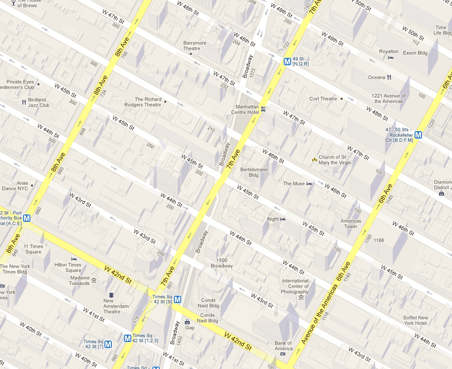
As it crosses the grid, Broadway's configuration in New York City’s Midtown caused some of the city's worst traffic back-ups and most hazardous pedestrian conditions. The stretch of Broadway included in the Green Light for Midtown pilot project witnessed 562 crashes involving pedestrians and motor vehicles between 1995 and 2005, according to Crashstat.org, making it one of the most dangerous stretches of roadway for walkers in all of New York City. By reducing traffic congestion, Broadway will once again become New York City's great walking street, perennial traffic back-ups will be solved and lives will be saved.
Adopted from: Transportation Alternatives
Between the gushing reviews of the new urban space and glorious pictures of pedestrian packed streets, it is easy to forget that the city’s Greenlight for Midtown program was primarily billed as a way to reduce traffic congestion throughout Manhattan by the most counter-intuitive means: taking away space from cars. Although induced demand and its inverse, sometimes called traffic shrinkage, have become accepted in transportation-planning circles, to have a concrete and beach chair-filled example of it at the crossroads of the world is an obvious boon for those who wish to make the case that closing streets to cars, rationalizing intersections and improving the pedestrian environment can be a sensible solution to vehicle congestion.
The redesign has been a success, not only in its much-lauded efforts to give pedestrians a bit more breathing room, but also as a counter-intuitive traffic curative for all the world to see. The project included several phases, including an initial visioning project by Project for Public Spaces, temporary changes and evaluation of results initiated by the New York City Department of Transportation (NYCDOT), and semipermanent designs. Construction of permanent plazas is anticipated in 2012.
Adopted from: Beck and Graham, 2009
Project for Public Places
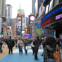
Still one of New York’s main draws, Times Square had become increasingly been a place where no one wanted to spend any time. Tourists, locals, and office workers were unsatisfied with their experiences there. Times Square offered little amenity or activity beyond its initial visual impact and, therefore, lacked a critical quality of every successful public space—it did not make you want to go back.
The Times Square Alliance hired Project for Public Spaces (PPS) from May 2006 to June 2007 to better understand and reimagine how Times Square performs as a public space. PPS began by gaining a better understanding of the district through systematic observation techniques such as time-lapse film analysis, activity mapping, and tracking and user surveys.
The general issues and opportunities that emerged from the analysis included:
Ground floors: Most building bases did not support sidewalk activity, gathering and smaller destinations.
No square there: Demand for use and activity in the median was very high, yet there were no amenities in the square to support this activity.
Movement and circulation: Street design did not support pedestrian movement – there was a lack of sidewalk space and crosswalks, and crossing times were inadequate.
Flexible spaces: The district needs flexibility to close side streets and Broadway at various times to facilitate planned events.
Reach out like an octopus: The area is not perceived as a district. Side streets, especially the theater blocks, were underperforming as destinations in their own right.
With these issues in mind, PPS also conducted comprehensive research of international best practices, drawing specific lessons from how other places have addressed similar challenges. Working with the client, PPS then developed key programmatic recommendations and conceptual plans. Recommendations included reconfiguration of streets to better accommodate foot traffic and reduce the negative impacts of traffic; architectural treatments and amenities to improve the pedestrian experience; retail strategies to diversify the district’s attraction; and new public space programming, such as performances and markets.
To help the alliance sell this vision to its partners and constituents, PPS developed a series of photo-simulations depicting the vision. PPS also presented its observations, best practices research and programmatic recommendations to a selection of leading designers to explore ways that they could creatively respond to and build on PPS findings and recommendations.
In addition to changes being implemented by the business improvement district, the New York City Department of Transportation’s Green Light for Midtown project was informed by these recommendations.
Adopted from: Project for Public Spaces
New York City Department of Transportation
The New York City Department of Transportation began implementing Green Light for Midtown in late May 2009. The work created new pedestrian areas on Broadway in Times Square (47th to 42nd Streets) and Herald Square (35th to 33rd Streets). Extensive safety improvements were also made along the Broadway corridor between Columbus Circle and Madison Square.
A feasibility analysis indicated that the project would improve traffic flow on 6th and 7th Avenues as well as improve traffic safety along Broadway. Both before and after implementing the temporary pilot project, NYCDOT collected extensive data on travel times, traffic volumes, pedestrian volumes and traffic accidents in the months just prior and just following project implementation. According to that data, the project delivered on its expectations.
Findings from data from GPS units placed in taxis helped NYCDOT understand the impacts to travel in and around midtown:
Travel speeds for northbound trips throughout West Midtown improved 17% from fall 2008 to 2009, compared with 8% in East Midtown.
Travel speeds for southbound trips in West Midtown fell by 2% while East Midtown showed an increase of 3%.
The speed of eastbound trips increased by 5% and westbound trips increased by 9% over the same time period.
Bus travel speeds increased by 13% on 6th Avenue and fell by 2% on 7th Avenue.
Safety has also been vastly improved as a result of this project:
Injuries to motorists and passengers in the project area are down 63%.
Pedestrian injuries are down 35%.
80% fewer pedestrians are walking in the roadway in Times Square.
And the project has had additional benefits as well:
74% of New Yorkers surveyed by the Times Square Alliance agree that Times Square has improved dramatically over the last year.
The number of people walking along Broadway and 7th Avenue in Times Square is up 11% and pedestrian volume is up 6% in Herald Square.
Based on these findings, plans are underway to make the Broadway changes permanent, including designing and building the plazas and corridor treatments with permanent, high quality materials. The NYCDOT also has completed the design of similar improvements to Union Square.
Adopted from: New York City Department of Transportation
reNEWable Times Square: Designing Temporary Surface Treatments
A winning design was selected to refresh and revive the streetscape designs currently at the Times Square pedestrian plazas while DOT moves forward with the area's permanent capital reconstruction project. Construction on the permanent plazas is expected in 2012.
Submitted by Brooklyn-based artist Molly Dilworth, the selected design is a graphic representation of NASA's infrared satellite data of Manhattan. Titled “Cool Water, Hot Island,” the artist's concept focuses on the urban heat-island effect, where cities experience warmer temperatures than rural settings. The proposed design's color palette of striking blues and whites reflects more sunlight and absorb less heat -- improving the look of these popular pedestrian plazas while making them more comfortable to sit in. The color and patterns evoke water, suggesting a river flowing through the center of Times Square, and they also provide a compelling visual counterpoint to the reds, oranges and yellows of the area's signature marquees and billboards.
Lessons Learned Potential Benefits:
Increases traffic flow by reducing the space devoted to vehicles in a highly visible location.
Increases pedestrian safety and the number of pedestrians walking in the area.
Provides amenities that supports social gathering.
Increases sense of place.
Utilizes temporary changes to collect data to support permanent change.
Builds support for the changes through temporary surface treatments.
Increases the visibility and attractiveness of pedestrian realm.
Increases sidewalk activities, such as outdoor seating.
Enhances pedestrian movement and circulation.
Provides flexible spaces for special events, social gathering, and street performances.
Potential Issues:
Impacts to businesses: There was initial resistance and fear from adjoining businesses about the potential impact.
Initial resistance: There was initial resistance from users of transportation modes, such as private automobiles, taxis, tourist operators, etc.