Category for Wayfinding

Case Studies
Multi-sensory Wayfinding: Urban Towns and Cities
Madurai, India and New York City, New York
categories
benefits
beautify streetscape, 
improve environment, 
reuse underutilized land, 
slow traffic, 

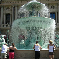
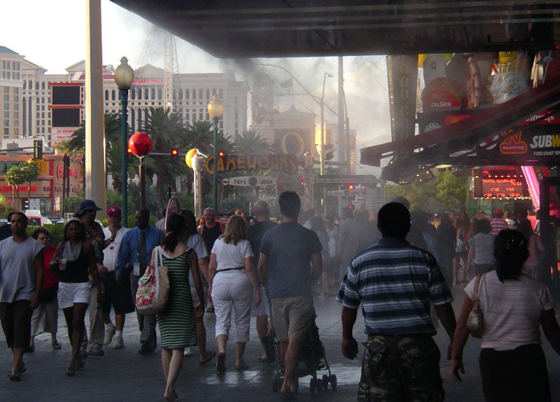
Historic urban cores in various towns and cities in United States and across the world have traditionally used the five senses to create memorable experiences. In the first half of the twentieth century, places could be recognized very easily by smells resulting from patterns of activities along streets. Newer developments in cities such as Las Vegas are building on this great tradition.

Sights, smells and misters along Las Vegas Boulevard in Las Vegas, NV

In Europe and older cities and towns in United States, bakeries were typically located in the town centers. Baking created streets with lingering smells of sweet dough and jams, followed by the excited clamor of families returning home to feast. Washday involved smells of heat, detergent and moisture, followed by the smell of ironing – all intensified when such work was performed by larger groups of women sharing facilities and equipment.

Madurai musicians

Smell is powerful. Research indicates that smell stimulates emotional or motivational arousal, whereas visual experience is more likely to involve thought and cognition. Odors affect us on a physical, psychological and social level (Classen 1994). Designers and planners have the opportunity to create memorable and revealing urban experiences for people through thinking about their projects through non-visual terms, conditions and outcomes. As an example of multi-sensorial city wayfinding, Madurai challenges designers to comprehend the city in an emotional and visceral way – not a rational, information and consumer-based understanding typical of western cities.

Madurai, India

Background

The sacred city of Madurai is located in the southern Indian peninsula and is a major religious site for Hindu celebration. The city is organized around a central temple complex. All roads lead to religious sites of one kind or another. Up to 25,000 people a day, mostly religious tourists, pass through the temple complex on a given day.

The city’s rhythm, culture and commerce are reflective of the ever-present religious functions in the city that spill out onto the streets. Temple incense, oils, coconuts, camphor, flowers for offerings and other scented religious elements are readily available for purchase from street vendors at open air stalls. Temple ceremonies are multi-sensorial experiences. They include “a plethora of sense impressions as one enters the temple: the images of the deities, the smell of the incense, the touch of the priest, the sound of the temple bells and finally the taste of the Prasad( Drahos 2011).”

During regular days, the City is bustling with activity. All the major commercial streets are shared roadways with multiple modes of travel that include vehicles, bicycles, auto rickshaws, and pedestrians. The specific design of the retail stalls, especially with regards to the engagement of the wares with the street edge, the hawking of the wares, the use of colors and unconventional use of shop signs create a unique multisensory experience. The intensity of outdoor use and the accompanying sensorial experience increases as on moves towards the city core. The streets immediately adjacent and leading to the temple are imbued with scents of flowers, incense and other materials such as sandalwood. Similarly, paving materials and patterns change and are discernible to people wearing shoes or barefoot. The paths inside and immediately next to the temple complex are made up of cobbled stones. Finally, the set of three gateways elements (gopurams) and the 153-foot high gopuram on the sanctum sanctorum provide residents and visitors with a strong set of visual markers that help orient oneself in any part of the city.

During religious festivals held throughout the year, the city becomes charged with the smells and sounds of celebration. During the Chithirai Festival in particular, the entire city is a place for the religious experience, with the sounds, smells, and visual celebration enveloping the city. Madurai becomes navigable and known to people through overlapping pungent scents and the sound of marching drummers and temple bells.

As a wayfinding inspiration, we can extrapolate Madurai’s experience to make sensory-enabling design concepts that can potentially be applied to cities here in United States.

Lessons Learned
Potential Benefits:

  • Brings a fresh, vibrant understanding of the city to people.
  • Can be a boon to merchants without access to technology or traditional forms of advertising to attract customers. For example, food markets found across the developing world rely on smells to lure people in and make their location known. Street buskers and musicians can set up where sound travels well to attract more onlookers.
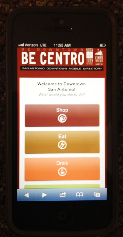
  • Provides a sensualized experience of place – a nice compliment to information-centric wayfinding (signage) and mobile device technology that depends on the internet.

Potential Issues:

  • Lack of support: There is cultural resistance, administrative barriers or misunderstanding regarding the use of non-traditional wayfinding approaches.
  • Environmental factors: Environmental factors (wind, temperature, ambient noise, cleanliness, etc.) can impact the effectiveness of multi-sensorial wayfinding more than it does traditional or electronic wayfinding.

New York City, New York

Background

Olfactory map of NYC’s summer smells (source: Edible Geography).

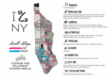
Jason Logan in an Op-Art piece in the New York Times (August 29, 2009) explored and documented the intended and unintended olfactory experiences of New York in summer. Titled the “Scents of the City,” Logan talks about how “New York secretes its fullest range of smells in the summer; disgusting or enticing, delicate or overpowering, they are liberated by the heat. So one sweltering weekend, I set out to navigate the city by nose. As my nostrils led me from Manhattan’s northernmost end to its southern tip, some prosaic scents recurred (cigarette butts, suntan lotion, fried foods); some were singular and sublime (a delicate trail of flowers mingling with Indian curry around 34th Street); while others proved revoltingly unique (the garbage outside a nail salon). Some smells reminded me of other places, and some will forever remind me of New York.”

Olfactory map of Columbus, OH (source: J B Krygier).

Lessons Learned
Potential Benefits:

  • Uses smells that are unique to a particular node, street, neighborhood or city itself.
  • Provides an opportunity to involve the adjoining businesses.
  • Creates a multisensory experience.

Potential Issues:

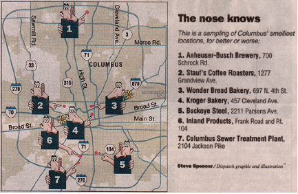
  • Undesirable smells: Undesirable smells can be part of the sensorial experience.
  • Unintentional smells: A number of the sensorial experiences are unintentional and unprogrammed.
  • Variability: Smells described in this case study are affected by seasonal and environmental factors (wind, temperature, ambient noise, cleanliness, etc.), which can impact the effectiveness of multisensory wayfinding.

Sources

Classen, Constance, David Howes, and Anthony Synnott. Introduction. Aroma: the Cultural History of Smell. London: Routledge, 1994. 1-2.

Drahos, Marta Hepler, January 9, 2011. "Northern People: Trip Fills Senses." Traverse City Record-Eagle. (http://record-eagle.com/features/x71340037/Northern-People-Trip-fills-senses)

Photo Sources

MIG, Inc.

Case Studies
Smart Apps for Better-Informed Wayfinding
Grand Rapids and San Antonio, Texas
categories
benefits
build community, 
improve environment, 
prevent violence, 

Grand Rapids

Background

GR Tag Tour website and branded logo. (source: Experience Grand Rapids)

Grand Rapids’ GRTagTour is a smartphone-enabled, 1-mile loop audio tour of 12 of Downtown Grand Rapids’ major landmarks, gateways and streets. The initiative is a project of the Grand Rapids Community Media Center. The audio portions of the tour were produced in conjunction with The Historical Commission and WYCE-FM.

The GRTagTour is designed to entertain and educate visitors and residents about the Grand Rapids community using mobile technology to bring location and information together on a user-friendly platform. The project developed a custom QR code icon that differentiates it as a brand people will recognize while out and about in the city.

A scanable barcode for each stop along the tour connects people to a mobile website containing:

GR Tag Tour website and branded logo. (source: Experience Grand Rapids)

  • Location facts
  • Audio history related to the location
  • A gallery of visitor submitted photos
  • Link to the Downtown Grand Rapids mobile site to find places nearby
  • Link to the third party mobile check-in application, Four Square
  • Walking map and directions to the next stop

The GRTagTour website takes the extra step to help people who are new to using QR-codes with their smart phone. The page provides clearly written information explaining how the technology works, how to use a scanner app, and how to immediately get started using the audio walking tour. A downloadable PDF map is available for those who prefer using a print resource. The website also gives people an opportunity to share uploaded photos taken on the tour and connect with others about the tour experience using social networking. People can provide tour feedback to the Community Media Center through e-mail or phone, which indicates an interest in collecting information from people that may not use smart phones.

C2: San Antonio

Background

San Antonio downtown website on iPhone, Source: MIG

Downtown San Antonio has a mobile smart phone friendly website and app. Created by the non-profit Downtown Alliance San Antonio, the website and app provides a very user friendly directory with maps, GPS enabled directions, events, mobile coupons and more. Launched in 2012, the website and app help provide all the necessary information to tour, stay, shop and dine in Downtown San Antonio. It also provides information about the different destinations, including the iconic River Walk, minimizing the need for traditional printed brochures and maps. While the smart phone friendly app and website provides information in several forms, there is room to more fully develop the application to enable user feedback and user contribution to the experience itself.

Background

San Antonio Riverwalk Source: MIG

Lessons Learned
Potential Benefits:

  • Provides a low-cost way to engage city visitors and younger people who are accustomed to using mobile technology for daily activities.
  • Can be updated at a central source.
  • Provides users with the opportunity to provide dynamic feedback.

Potential Issues:

  • Signs: QR code tours and wayfinding features still require the use of traditional signs to post the actual code near the attraction.
  • Temporary signs: Temporary, low-cost signage can be quickly installed but does not weather well and can look like an afterthought.
  • Non-smartphone users: QR code tours and wayfinding may not provide the same experience for people who do not own personal smart phone devices.
  • Breakdown: May be subject to breakdown with technology glitches, disabled internet or phone networks

Sources

Olivo, Benjamin, May 12, 2011. "New River Walk Tour Uses QR Technology | The Downtown Blog | a MySA.com Blog." Blogs - San Antonio Express-News. (http://blog.mysanantonio.com/downtown/2011/05/new-river-walk-tour-uses-qr-technology/)

Photo Sources

MIG, Inc.

Case Studies
Naked Streets
Laweiplein, Drachten, Netherlands
categories
benefits
beautify streetscape, 
improve environment, 
reuse underutilized land, 
slow traffic, 

Background

There is no consensus regarding the proper aesthetics of street wayfinding. However, most people do agree that streets cluttered with an overabundance of wayfinding elements pose potential safety risks to distracted drivers and pedestrians – and obscure the legibility of the street itself.

The Naked Streets model advocated by Hans Monderman, which uses the deliberate removal of pedestrian-oriented safety and navigation features, such as traffic lights, railings, curbs and road markings, encourages communication between drivers and pedestrians that did not exist before. Sharing previously segregated space “exploit[s] the natural skills of humans to negotiate movement, resolve conflict and engage not only with each other but with their context. Shared space might look chaotic, but people are using their brains and intuition, not acting as mere automatons in response to signals from on high (May 2009).” Places that have used Naked Streets (also known as Living Streets) design concepts to address problematic street intersections have seen positive safety outcomes while also enjoying benefits of an uncluttered streetscape.

One example is the roundabout at Laweiplein, Drachten in the Netherlands. Here, approaching drivers perceive the unsignaled roundabout as utterly ambiguous, which causes them to slow their speed. The intersection serves 20,000 cars each day. Before the 2003 redesign, the intersection was signal-controlled with distinct zones for pedestrians and drivers. The redesign removed the signals and replaced them with a roundabout. Texturized pavement was installed where the sidewalk merges with roadway. Illuminated fountains at the four corners articulate and soften the intersection’s edges (Garrick 2006). Results of the intervention are positive with a 20% reduction in accident rates and shorter cross-city commute times. This suggests that shared streets are not just for low-volume local streets.

Benefits extend beyond measureable safety improvements. Laweiplein’s surrounding commercial and theater district has also experienced revitalization since the completed intersection improvements (May 2009).

Lessons Learned
Potential Benefits:

  • Demands that drivers, cyclists and pedestrians think, evaluate and act on real-time feedback they are receiving from other road users, resulting in safer, slower drive speeds.
  • Produces measureable reductions in traffic altercations and personal injuries.

Potential Issues:

  • Applicability: The shared streets approach with no signals or signage cannot be applied to any intersection. It hinges on several dependent factors, such as traffic volumes, intersection geometry, topography and the prevailing mix of users (drivers, pedestrians, cyclists) (Vanderbilt 2011).
  • Social norms: Shared streets interventions may work better where social norms do not overly privilege the individual nor reward litigious behavior.
  • Safety: There is no more assurance of safety with shared streets than there is with conventional intersection design. There will always be some that break the rules.
  • Accident liability: When accidents do happen, it may be more difficult to determine the party at fault.

Sources

Garrick, Norman W., June 22, 2011. "The Art and Science of Shared Streets, A.k.a. “Naked Streets”," Congress of New Urbanism - New England. The University of Connecticut School of Engineering, 12 Oct. 2006. Web. ( http://www.engr.uconn.edu/~garrick/articles/Congress%20of%20New%20Urbanism%20-%20New%20England%20Chapter.htm)

May, Matthew E., 2009. “In Pursuit of Elegance: Why the Best Ideas Have Something Missing” New York: Broadway

Vanderbilt, Tom, June 30, 2011. "The Traffic Guru." The Wilson Quarterly 32.3 (2008): 26-32. The Woodrow Wilson Center. Web. (http://www.wilsonquarterly.com/article.cfm?AID=1234)

Photo Sources

MIG, Inc.

Case Studies
Hierarchical Wayfinding
Portland, OR & Philadelphia, PA
categories
benefits
beautify streetscape, 
build community, 
improve environment, 

Background

Examples of Walk Philadelphia signage (source: Center City District)

The wayfinding systems used by Portland (Portland Central City Pedestrian Wayfinding Signage Project) and Philadelphia (Walk!Philadelphia) use similar aesthetics for static signage to connect districts and highlight transportation features.

In Downtown Portland, the wayfinding system connects people to shopping districts, public plazas, waterfronts, museums, landmarks and gateways. The system links people to high-quality transit options, such as MAX Light Rail, city streetcar and bus service. Color-coded signs and map elements create a destination hierarchy and simplify understanding of the city’s layout. The wayfinding elements in Portland include free-standing, ground-mounted signage that use a combination of location identifying text (e.g., Downtown, Pearl District, Goose Hollow, etc.), directional signs and maps that help pedestrians navigate between major regional destinations, parks, historic sites, neighborhood attractions, and transit stops. A list of simple icons and the vibrant color palette make map reading effortless. Portable versions of walking maps are available and distributed by downtown businesses. In the future, it is conceivable that smart phone apps will reduce the need for printed maps.

Examples of Walk Philadelphia signage (source: Center City District)

The Walk!Philadephia wayfinding system also organizes navigation around the presence of distinctive city districts, such as the Convention Center, Rittenhouse Square District and the Historic District (Old City). Signage emphasizes the ease of walking in the city. Color-coded ”heads up” disk-maps include comfortable 10-minute walking radii that highlight nearby destinations. Route choice is reinforced with simple directional arrows. The Walk!Philadelphia project also developed simple two-color branded logos for its five downtown districts, which highlight the iconic features you encounter while walking through the city.

Any static wayfinding system experiences awkward growing pains as the city continually develops and matures around it.

Examples of Walk Philadelphia signage (source: Center City District)

Major downtown transit renovations and construction of Portland’s Green light rail line between 2007-2010 rendered directions on many of the signs inaccurate. Commentary on citizen transit blogs also describe a variety of signage inaccuracies ranging from arrows pointing the wrong way to suggested routes which might be the shortest but not the most enjoyable or interesting for visitors.

Downtown Portland two-faced ground-mounted sign (source: MIG)

Lessons Learned
Potential Benefits:

  • Makes it inviting and easy for visitors to hop on and off transit downtown.
  • Makes destinations easy to locate through the use of simplified graphic design, bright colors, clear typeface choice and regularly spaced placement of signs along streets.
  • Provides opportunities to fund upkeep through a sponsorship program that allows any businesses, public agency, non-profit organization or professional service provider to choose what signs they want to sponsor and makes their name visible to hundreds (thousands) of people per day (Portland).

Downtown Portland two-faced ground-mounted sign (source: Portland Bureau of Transportation)

Potential Issues:

  • Multiple sign systems: The Center City District of Philadelphia had to develop a parallel signage system for visitors entering the city by vehicle, named Direction Philadelphia. Direction Philadelphia signs use fewer colors than Walk!Philadelphia signs, but they are similar enough that pedestrians may think they are the same thing or be thrown off slightly.
  • Inaccurate signage: Ongoing Downtown Portland transit construction changed the locations of bus pick up areas and light rail lines were not updated on signage until construction was finished; signs were inaccurate for three years
  • Graphic design: Simplified cardinal graphic conventions on both signage systems mean directional arrows sometimes don’t correctly point to destinations or travel routes.

Sources

Center City District. “Walk!Philadelphia” (http://www.centercityphila.org/docs/walkphila_infosheet.pdf)

Portland Bureau of Transportation. “Pedestrian Wayfinding Signs” (http://www.portlandonline.com/transportation/index.cfm?c=40500)

Photo Sources

MIG, Inc.

Wayfinding > Best Practices > 08 c
c.
Collect user feedback to help inform and shape the wayfinding experience of future users. (Example: develop apps that enable user-created content to “rate” destinations and features along a street. Develop alternative ways for those not using smartphone devices to also participate.)
Image Gallery
Wayfinding > Best Practices > 08 b
b.
Develop a social media presence for streets that advise people of upcoming events, exhibits or attractions – advertise using print, digital, radio, etc.
Wayfinding > Best Practices > 08 a
a.
Create step-by-step guides that assist novice users of smart technologies to download apps and launch them on personal devices.
Image Gallery
Wayfinding > Best Practices > 07 d
d.
To reinforce branding recognition of destination streets, customize the visual design, color and pattern of QR codes (Example: San Antonio’s “Get Lost” QR code).
Wayfinding > Best Practices > 07 c
c.
Develop apps that address needs of underrepresented user groups, such as youth, seniors, non-English speakers or minorities.
Wayfinding > Best Practices > 07 b
b.
Utilize geo-coded QR (quick-response) code technologies and smartphone applications to direct people to information they need to make educated decisions.

Pages

Subscribe to RSS - Wayfinding