Background
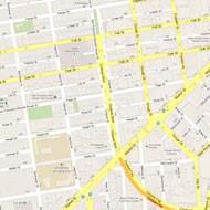
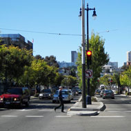
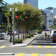
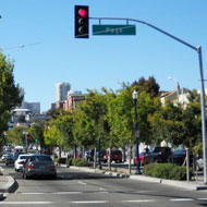
Octavia Boulevard lies on Octavia Street between Fell and Market Streets in San Francisco, where the touchdown ramp of the elevated Central Freeway starts. The four blocks of Octavia Street became a boulevard in 2005, and include four central lanes of one-way, high-speed traffic. Local access side lanes are separated from through traffic by landscaped medians that buffer cyclists, pedestrians and residents from traffic. The surrounding neighborhood of Hayes Valley, blighted by the freeway since the 1950s, has been revitalized and has become livelier as housing fills in a strip along the boulevard's east side left vacant by the freeway's demolition.
The freeway removal had long been discussed, but it was spurred by the irreparable damage of portions during the Loma Prieta earthquake of 1989. In November 1998, San Francisco voters approved Proposition B, a measure that authorized Caltrans to replace the Central Freeway with an elevated structure to Market Street and a ground-level boulevard from Market along Octavia Street to Fell Street. The Central Freeway Replacement Project, a joint project between the City, Caltrans and the San Francisco County Transportation Authority, began in March 2003 with the demolition of the existing Central Freeway structure.
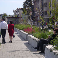
Despite the concerns about traffic congestion with the freeway removal, the boulevard distributes traffic smoothly and evenly throughout the immediate neighborhood while maintaining links to the major San Francisco traffic arterials served by the old elevated freeway, including Fell and Oak Streets, serving the city's western neighborhoods,and Franklin and Gough Streets, serving northern neighborhoods and the Golden Gate Bridge. The demolition of the existing freeway structure and the construction of its replacement touchdown ramp were undertaken by Caltrans at a cost of $26 million. At the boulevard’s northern end where it meets the retail strip of Hayes Street, a new 16,500 square foot park, Patricia’s Green, was built as part of the project. Parcels freed up by the freeway demolition are being redeveloped into nearly 1,000 units of housing. The corridor, which used to carry 93,000 vehicles per day before elimination of the eastbound lanes, now serves 45,000 vehicles per day with some of the remaining traffic displaced onto alternate routes.
Adopted from: Seattle Department of Transportation 2008
Two urban planners—Allan Jacobs and Elizabeth Macdonald—initiated the idea of a livable boulevard in American cities. The “Great Street” book, a culmination of their study, concludes that boulevards can be pleasant, functional and, contrary to their reputation in America, not dangerous at all (Ward, 2005).
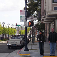
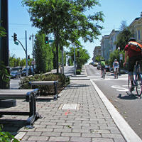
The new Octavia Boulevard is visually appealing and pedestrian-friendly, thanks to generous landscaping, side lanes for local traffic and parking, special considerations for details like views from side streets, and pedestrian amenities, such as special light fixtures, paving pattern and art. The new park, Patricia’s Green and tree-lined pedestrian walkways add more green space, functioning as a linear park in the neighborhood.
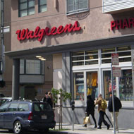
Before the destruction of the Central Freeway, condominium prices in the Hayes Valley neighborhood were 66% of San Francisco average prices. However, after the demolition and subsequent replacement with the new Octavia Boulevard, prices grew to 91% of city average. Beyond this, the most dramatic increases were seen in the areas nearest to the new boulevard. Furthermore, residents noted a significant change in the nature of the commercial establishments in the area. Where it had been previously populated by liquor stores and mechanic shops, soon the area was teeming with trendy restaurants and high-end boutiques.
Adopted from: Congress for the New Urbanism
The streetscape design has created new pedestrian and bicycle facilities without dramatically impacting automobile traffic. In February 2007, the San Francisco Department of Parking and Traffic published an evaluation of boulevard operations and its impacts on the surrounding area. Despite the reduced capacity of Octavia Boulevard, traffic along detour routes in the adjacent South of Market district returned in the months after its opening to pre-freeway closure levels. Of the half-dozen points observed, three experienced decreases in traffic, while none experienced increases greater than 10%. This, along with the reduction in traffic on Fell and Oak streets, would seem to indicate a significant reduction in discretionary trips and overall traffic in the corridor. A 1996 survey conducted six weeks after closure of the freeway’s eastbound lanes found that just 2.8% of former freeway drivers no longer made their trips and just 2.2% of trips had been shifted to transit. However, nearly 20% of respondents said that they had made fewer trips since the freeway’s closure.
Because the new boulevard did not open for several years after the freeway closure, it was initially perceived as a significant addition of capacity for drivers. During the initial weeks after the boulevard opened, the city increased the number of traffic control officers in the area, and it made a number of adjustments to signal timings until the new system reached equilibrium.
Adopted from: Seattle Department of Transportation 2008
Lessons Learned
Potential Benefits:
- Improves safety: Provides a safer environment for pedestrians with more sidewalks and medians, residential access lanes, and less crime. The at grade street design also helps create more eyes on the street and improves the overall sense of safety.
- Increases real estate value and spurs residential and commercial development.
- Increases pedestrian amenities, such as parks, green space and street furniture.
- Decreases traffic volume and, thus, air pollution and noise in the neighborhood.
- Generates revenue from sales of excess freeway right-of-way space to fund construction of public amenities such as Hayes Green.
Potential Issues:
- Some backups and spillover: Peak-hour congestion on Octavia Boulevard has sometimes resulted both in backups on Oak Street and spillover onto the parallel neighborhood streets—Page Street and Haight Street.
- Transit delay: Buses on Page Street, which cross the boulevard, can be delayed during the morning peak.
- Safety issues: Injury accidents have increased at a rate consistent with increases in traffic--the approximate reported collision rate of the intersection (average daily traffic of 45,000 on Octavia Boulevard and 5,500 on Page Street) is 0.06 collisions per million vehicles entering the intersection (Olea 2007).
- Illegal right turns: Where Market Street meets the boulevard and Central Freeway, motorists regularly make illegal right turns onto the freeway and sometimes collide with bicyclists—colored pavement in the bicycle lane is under consideration.
- Long crosswalks: Pedestrians found that the crossing signal time is too short to get across the wide street right-of-way (approximately 109 feet) (SFCTA).
- Implementing initial design concept: Several original design features were not incorporated in the final configuration.
- At 18’-6” the side lanes are wider than was intended, and their asphalt pavement is not the textured, traffic calming surface that was recommended.
- Side lanes are controlled not just by stop signs, but also by flashing red lights; yet the 2007 evaluation found a fair amount of noncompliance, confusion and risk among drivers.
- More traffic calming features:
- Traffic volume in the side lanes: While the side lanes were designed to serve as access routes for local residents and businesses, traffic queued along the southbound side lane at the boulevard’s northern end, resulting in a requirement that drivers turn right.
- Traffic speed: The side roads are signed for a speed limit of 15 MPH, but according to a one-day speed survey taken in 2006, 85 percent of motorists traveled at speeds of 27 MPH or lower on the northbound side roads.
- Speed humps: In 2009, speed humps were added to the northbound side road segments, resulting in 85% of traffic speeds dropping to 22 MPH and traffic volumes dropping by almost half (Olea 2007).
Adopted from: Seattle Department of Transportation 2008
Sources
Congress for the New Urbanism. “San Francisco's Octavia” (http://www.cnu.org/highways/sfoctavia)
San Francisco County Transportation Authority (SFCTA). “Central Freeway and Octavia Boulevard Circulation Study” (http://www.sfcta.org/octaviacirculation)
Seattle Department of Transportation, January 2008. “Seattle Urban Mobility Plan Briefing Book-Chapter 6. Case Studies in Urban Freeway Removal” (http://www.seattle.gov/transportation/briefingbook.htm)
Olea, R, 2007. “San Francisco’s Octavia Boulevard” (http://www.westernite.org/annualmeetings/sanfran10/Papers/Session%202_Papers/ITE%20Paper_2B-Olea.pdf)
Ward, J, June 13, 2005. ”Where the highway ends” Metropolismag. (http://www.metropolismag.com/story/20050613/where-the-highway-ends)
Photo Sources
MIG, Inc.

